I can still feel it–the exhilaration of flying along the two-lane highway through the Alleghenies: the Lincoln Highway, once touted as America’s Main Street, in Pennsylvania!
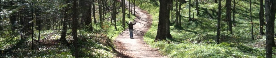
This was the year, you see, that I was going to do the Lincoln Highway, the nation’s first coast-to-coast automobile highway, eastward from Indiana. I had always planned to take a week; I was sure I would need it. But life intervened as it will. I broke my leg, so I could not drive for a month (I have a stick, of course!) and even if I could, I was not getting around all that well for clambering in and out of a small pickup truck. The year grew late, but miraculously–one might say tragically, since climate change is the cause–autumn lingered and with it, lovely weather and the most beautiful light. I found four free days. Not enough, as I soon proved.
Since I do not live on the Lincoln Highway I had to start out early to catch it about halfway through Ohio, east of Mansfield. I have done the routes in this state before (and written about them, see past blogs), but only a couple of times past Canton. Wooster is a favorite town, though, so I did drive through, past its over-the-top courthouse, oddly placed on a corner lot with no surrounding grounds. Passed through Massillon, with its fantastic library overlooking the town–a 1930s WPA project that adapted a mid-19th century mansion into a stunning repository of books. Reached Canton, with its over-the-top courthouse.

From there the highway meanders in a slightly southeasterly direction through ever-higher hills. At Robertsville, where parts of the original brick road that I saw several years ago are now paved over, I took a marked Lincoln Highway bypass and become hopelessly lost on beautiful rural roads. If I’d had more time it would not have mattered, and I would have further explored the charming little town of Malvern, where I wasn’t supposed to be. There I found myself on a highway where a sign informed me I was going both north and south at the same time. It’s true! Routes 43 and 183, North and South, respectively. Get off the Lincoln Highway and enter the Twilight Zone
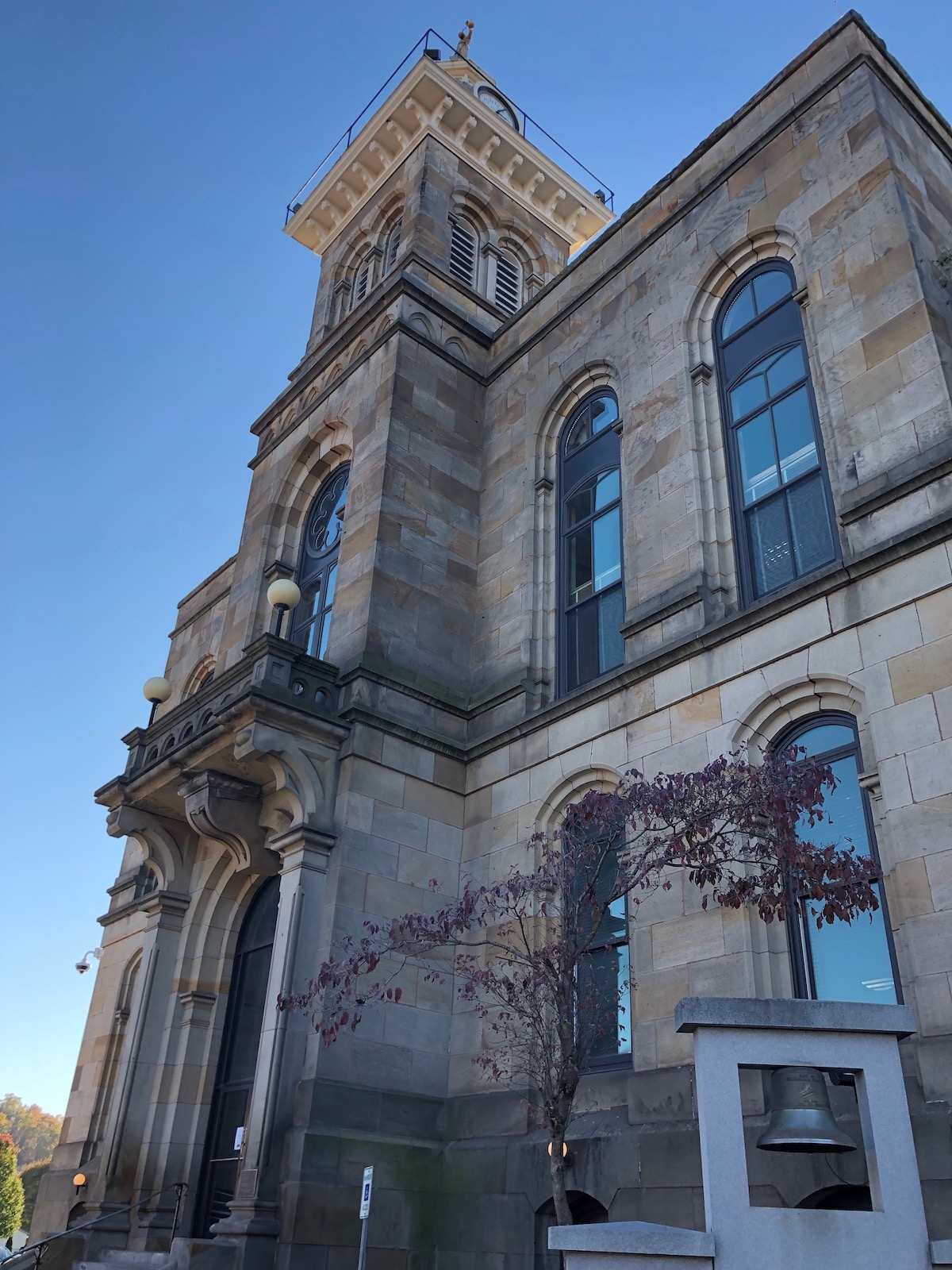
Found my way to Minerva and back on the Road, on to Lisbon (“oh no, that cute little drugstore with the fresh roasted nuts is gone!”) with its lovely square and 1871 courthouse.
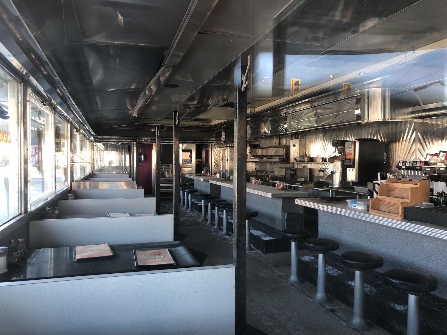
And the Steel Trolley Diner, a classic, was also, sadly, closed–permanently? Signs were unclear. It was for sale–and I never got to eat there.
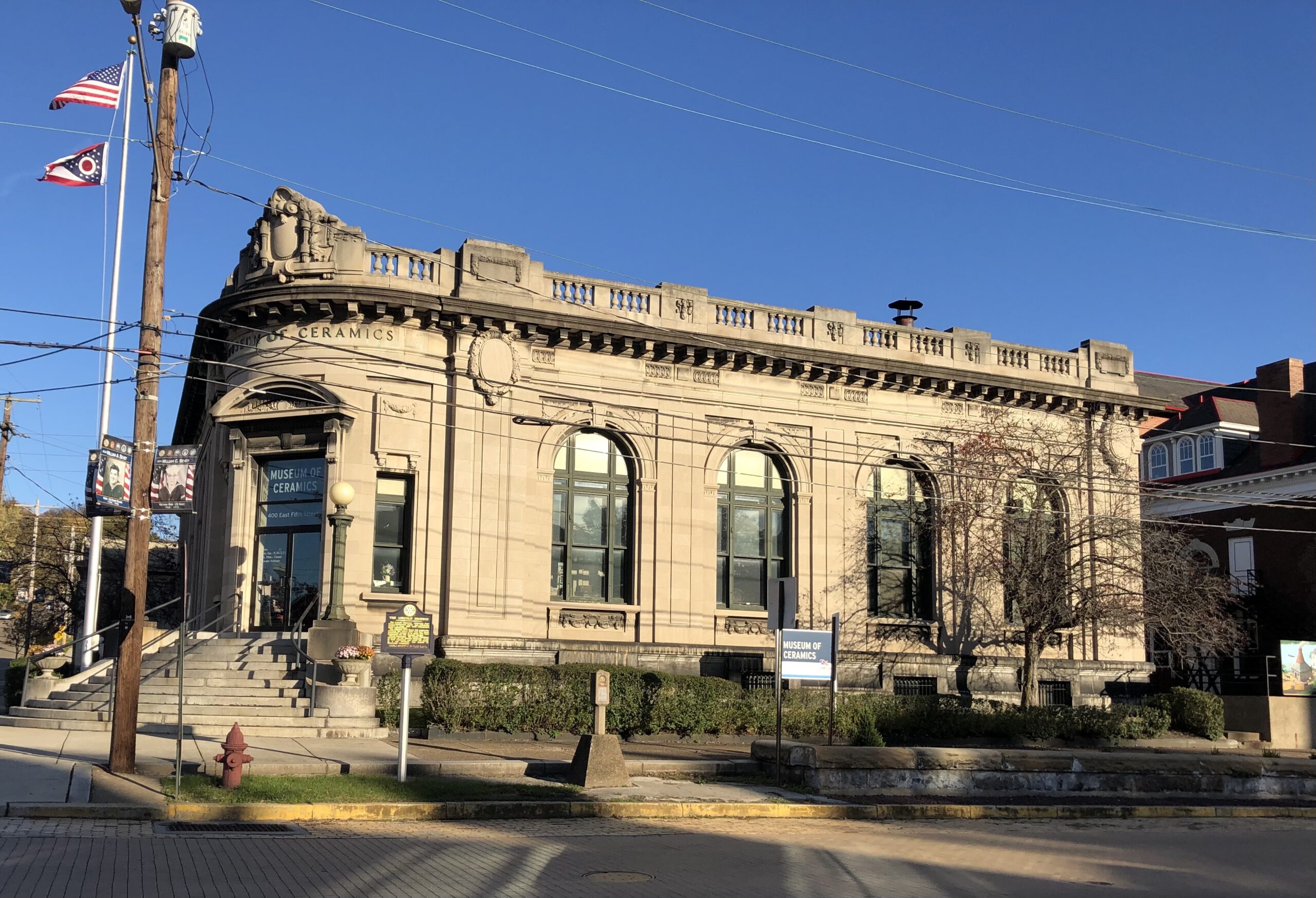
East Liverpool on the Ohio River at last, once home to scores of pottery manufacturers, now home to the Museum of Ceramics, located in the former downtown post office.
Late afternoon and it was November, after all, with earlier sundowns, plus I was heading east, into even earlier sundowns. I had miles to go before I slept and the prospect of driving through unfamiliar mountains in the dark. So I chose a later, shorter iteration of the Lincoln Highway route that crossed into West Virginia for a short stretch. I found the US30 bridge across the Ohio River much blocked by construction.

Erected in the 1970s, the massive steel truss bridge resulted in a reconfiguration of the Lincoln Highway’s crossing and routing on both sides. The route now skirts the north edge of Chester, West Virginia, where, along with Newell just to the south, most of the rest of the pottery factories were located (and Homer Laughlin still is.) A box truck that had pulled in front of me resolutely remained, so my enjoyment of this hilly, winding two-lane road was greatly diminished–and slowed! Pittsburgh was less than 50 miles away, but would I get beyond it before dark?
It was not to be. I reached an interstate bypass and determined to take it in order to get around Pittsburgh quickly, but that was not to be either! There were hopeless jams and tunnels with major construction projects. Foolishly I briefly got off downtown–straight into the traffic of that evening’s football game (what do I know about Monday night football?) I saw the Lincoln Highway route through downtown, the Boulevard of Allies, but it was a sea of cars. Frantically I managed to return to the bypass as the sun dipped behind the mountains. One more tunnel (also under construction) and I got off the bypass into a very tony forested suburban area.
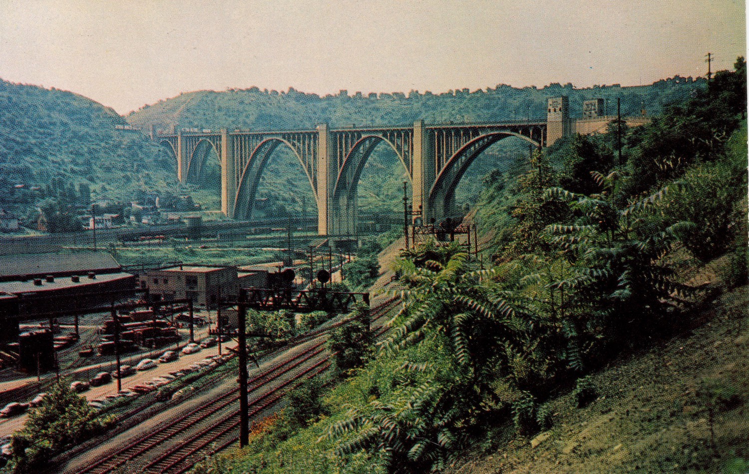
Unknowingly in the twilight I crossed the stunning George Westinghouse Bridge built in 1932 and soon was driving through every type of sprawl imaginable. Fancy lifestyle centers. Auto dealerships. Strip malls. Fast food. Ugh. Not for me. Given the distance I had to cover, I had earlier opted to stop for food I could eat on the road: cheese curds and dried cherries purchased at Shisler’s Cheese House back in Ohio, west of Massillon. I was getting hungry and had hoped to have supper at some sort of diner or cafe. Though dark, it was still early, and I figured that soon I would be free of all the sprawl and in the mountains. But the sprawl went on and on and on.
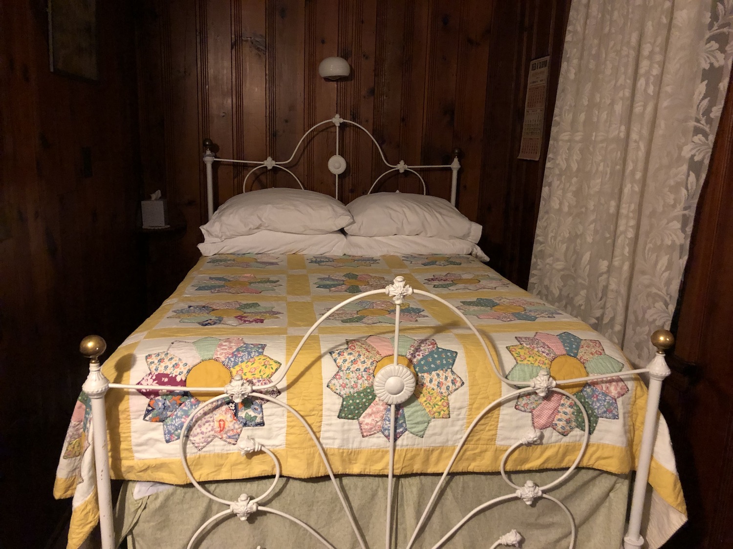
Then suddenly all was dark. Very dark. All at once the mountains seemed to loom all around me. The narrowed road curved and dipped like the wildest roller coaster. I was climbing and descending in third gear, even second–once even in first. I kept passing signs–jumping into my headlights like scary mannequins on an amusement park dark ride–warning trucks to stay in low gear and other signs telling them to stop (and let things cool, I assume?) There were several runaway truck slopes, too, heading off into the darkness. I had no idea how close to the edge I was, nor much “down” was beyond it. Apart from those truck ramps, there were no places to pull off to the side. Harrowing? You bet. The mountains were heavily forested and I could see no lights. Rarely, I slipped through tiny stringtowns with no apparent businesses, only a few precarious houses hanging onto the edge of the road. No diner beckoned; I stopped for some gas at Jennerstown, which was supposed to have one, but I did not see it and I did not know how far I still had to go. Finally I rolled into what I later learned was Schellsburg and saw a most welcome grocery and deli! The folks inside blinked at me as if I were a Martian, but a sign advertised any deli sandwich $2.75. Fantastic! I ordered, fell gratefully into a chair along with my maps and route books and discovered I was less than five miles from the Lincoln Motor Court, my destination for the night. Hallelujah! I packed up my half-eaten sandwich and headed east; an oasis in the desert could not have been a more welcome sight. The owners, who, alas, have the place up for sale (but hope to sell it to someone who will continue its 80 years of tradition) were lovely and “old shoe,” as my mother used to say. They handed me the key to cabin 12 just across the driveway. I opened the door and exclaimed with delight.
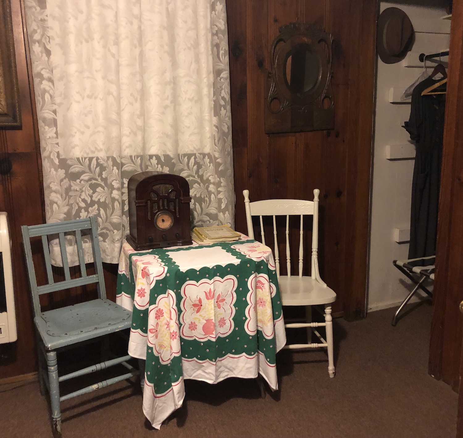
There was a shimmer and I was in the 1940s, and my vehicle parked outside was not a Ford Ranger but a sturdy Model A, resting from its extreme endeavors just accomplished. The Lincoln Motor Court is said to be the last collection of tourist cabins still open on the Lincoln Highway. The rooms appear as they did in the first decades of the cabins’ existence. I finished my braunschweiger, tallied up the day in my journal, and sank into an unimaginably comfortable bed. I would be well rested for more adventures in the morning.
Wonderful, Glory. I look forward to the next installment!