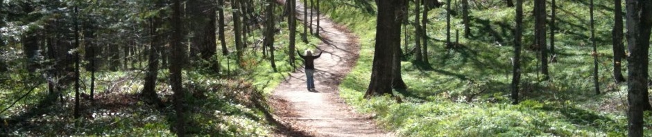
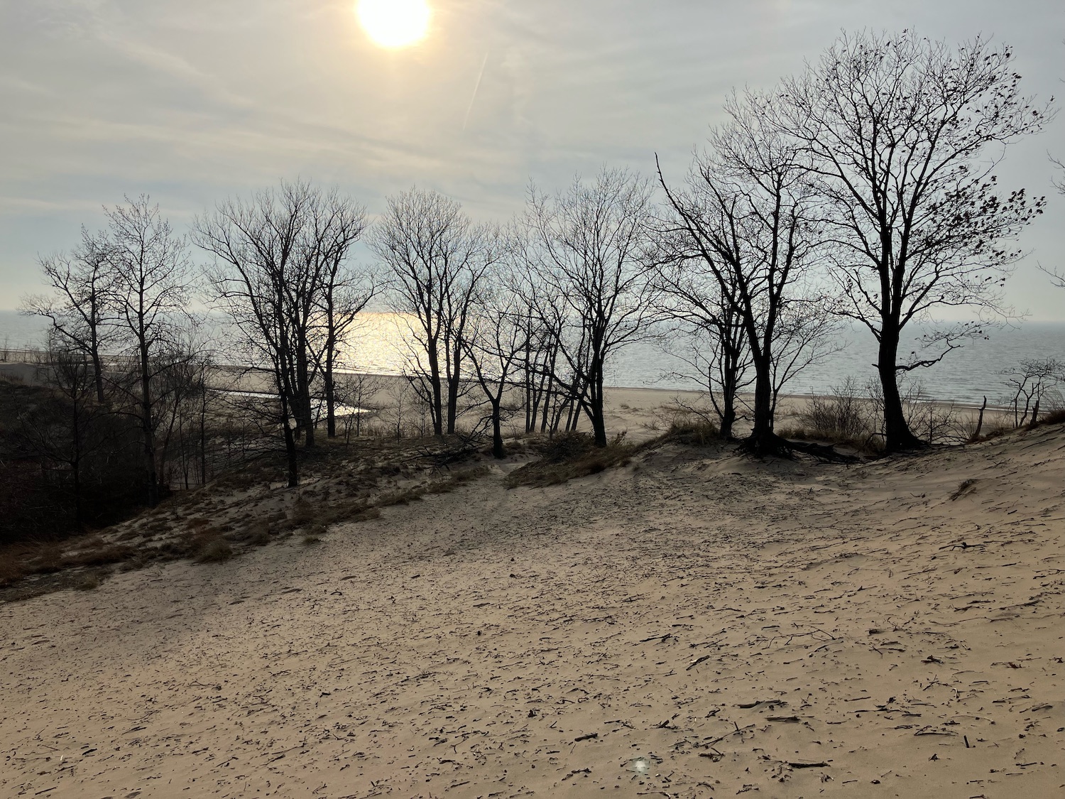
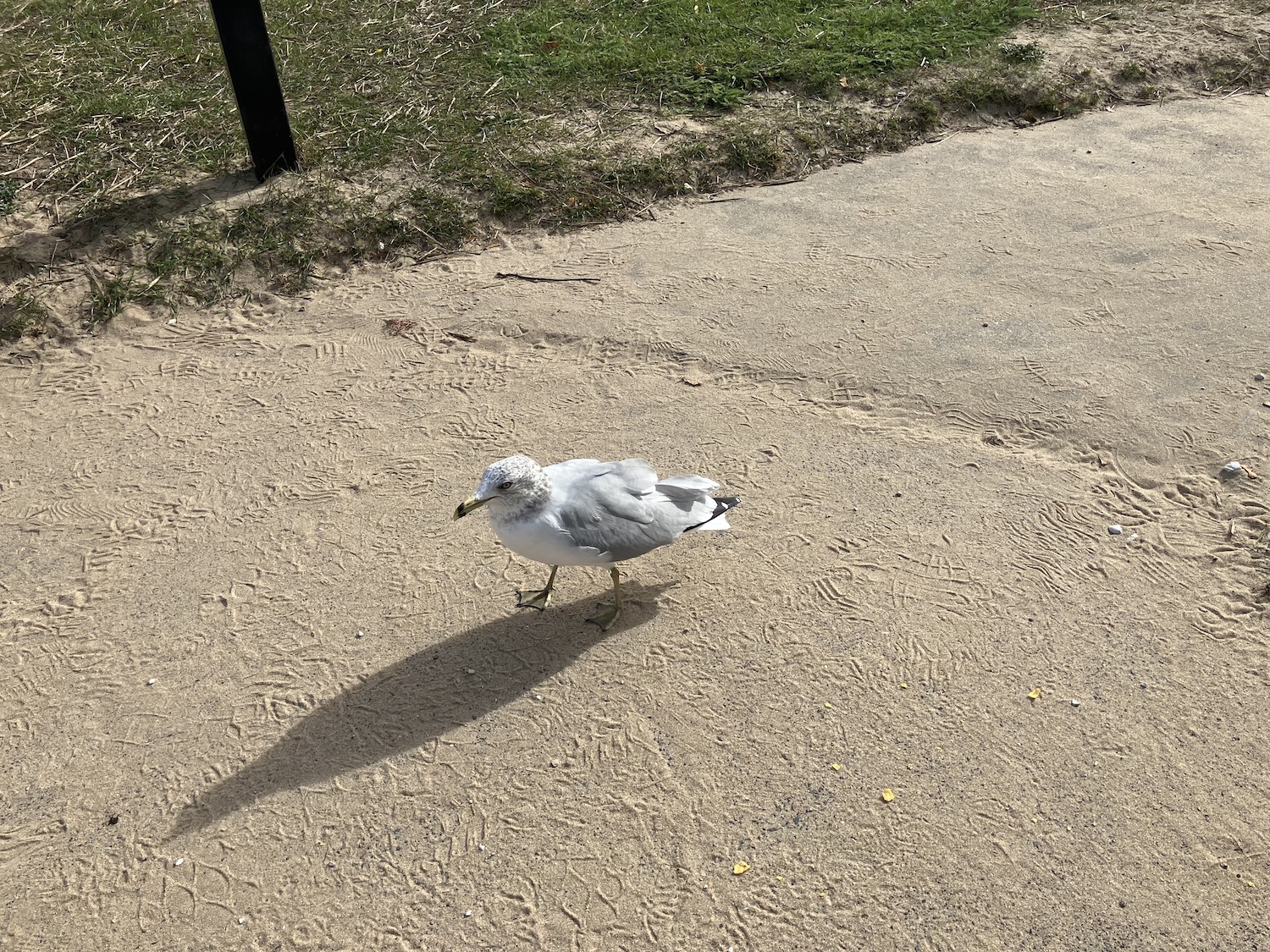
As a Michiana native who left her heart behind, I was suffering from severe Lake-deprivation. Always the Lake, yet it is so far from my dwelling place. (I hesitate to say “home,” because is not home where the heart is?) And here it was, the first day of spring. I could not ignore the Lake’s siren call.
It is a good three to four hour drive. But the Lake is not be resisted. Already the hour was late; where should we meet? St. Joseph seemed to be the quickest place of encounter, but upon arriving at last, I realized it was the dunes that were insistently whispering to me. Fortunately, twenty minutes or so brought me to Bridgman and the dunes of my youth. And all was well.
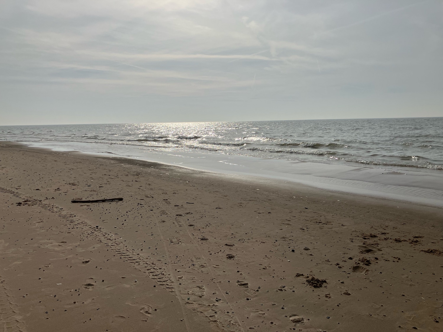
Some would find this place
bleak, drab, even desolate–
all sand and dead trees and those not yet wakened,
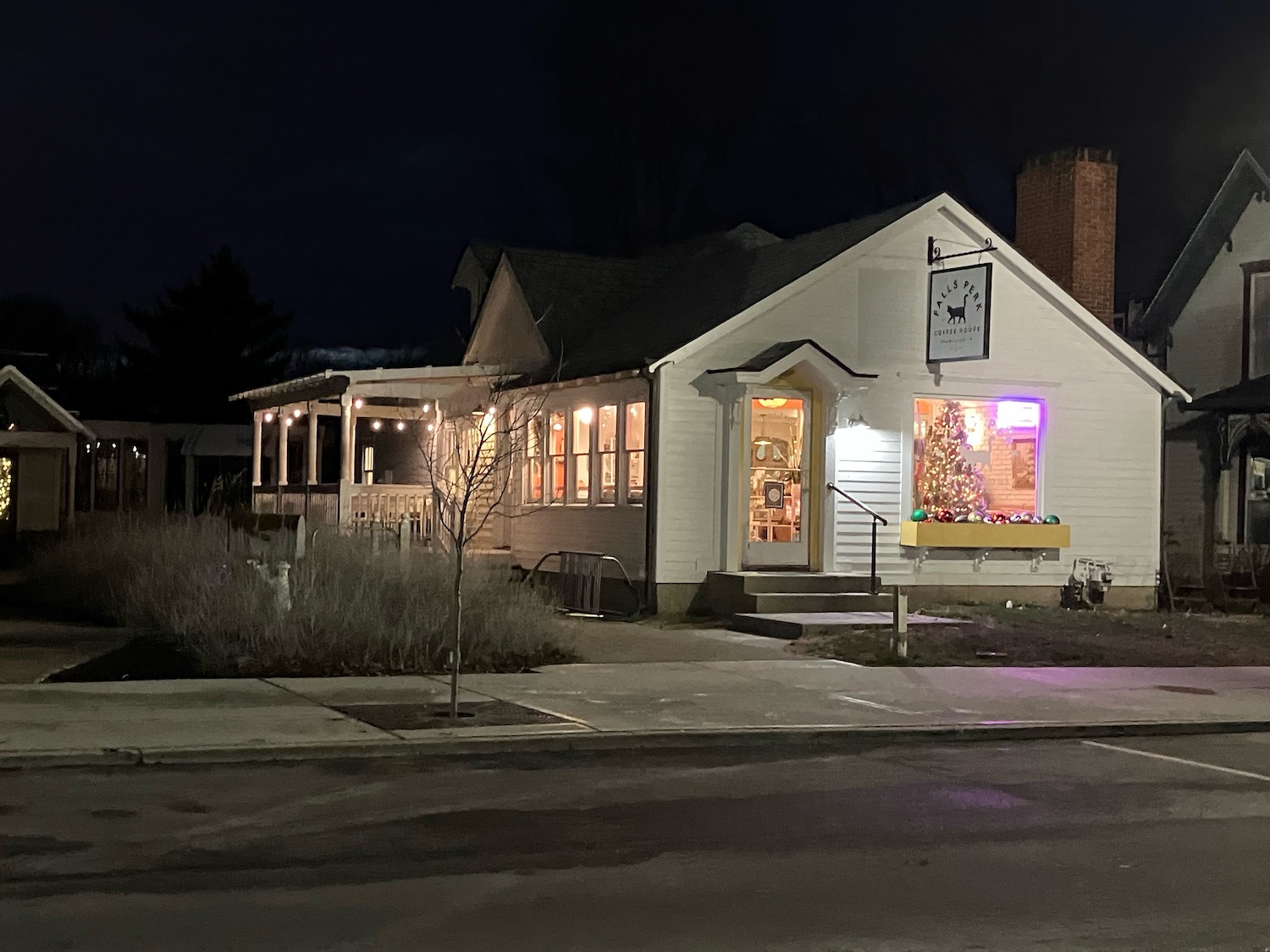
Yesterday, sunny and not too chilly,was a good day for a long pre-solstice walk at Falls Park in Pendleton, fortified with hot chocolate from one of my favorite coffeehouses, Falls Perk.
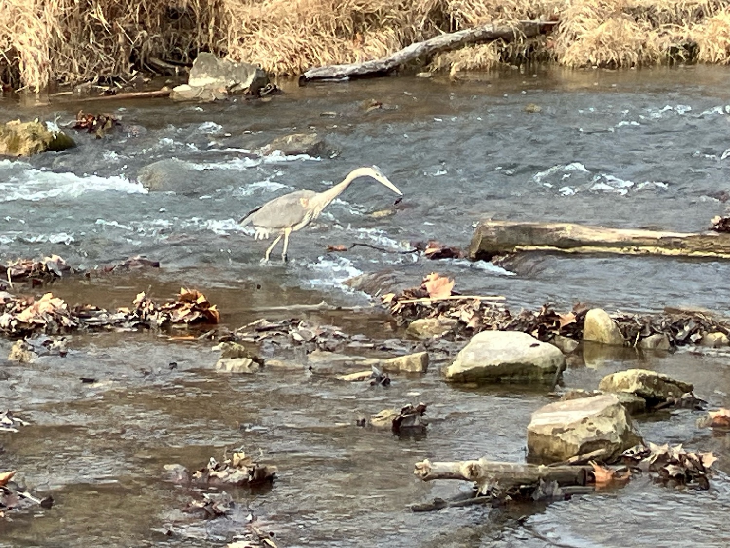
I bowed in great respect to the heron, who was busily fishing–with great success, I might add.
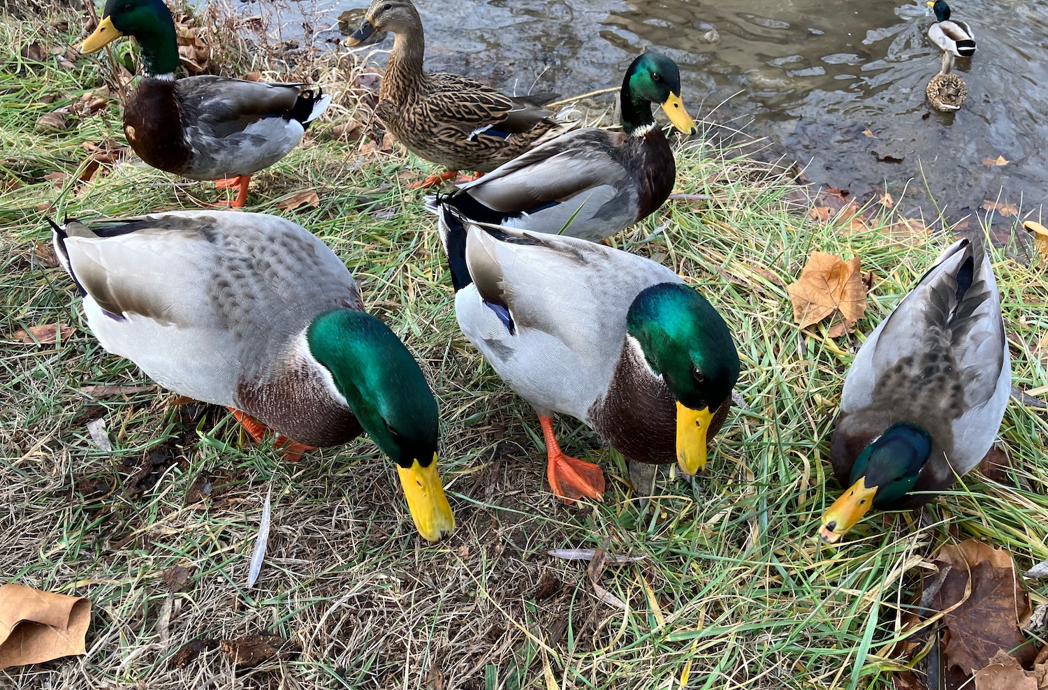
I walked into a scrum of gleaming ducks, who were clearly starving, or so they said when they saw I had food. Likely these were the same babies I had fed last spring. They were scrambling all over my feet just as they had then. Heading upstream toward the bridge, I saw another heron, who was uninterested in posing and glided off in all its magnificence.
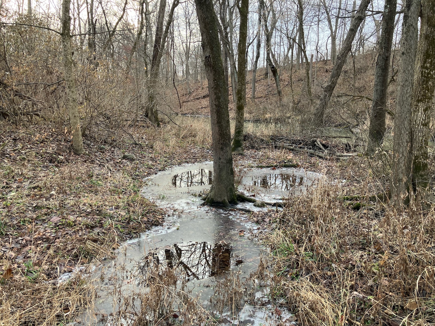
Crossing the bridge, I walked on into the snowless but very wintery woods where a cardinal flashed me in his brilliant coat and a deer leaped across my path. I breathed deeply of the fresh brisk air. A poem I’d composed decades ago popped into my head. It had been written in February, but obviously, what was once seasonal is rapidly changing. These are the ending lines:
There is beauty in neutrality.
Brown woods and white swamp
and invisible hands in the breezes
that guide my wandering way.
Darkness fell with a thud, as it does this time of year. Time to leave.
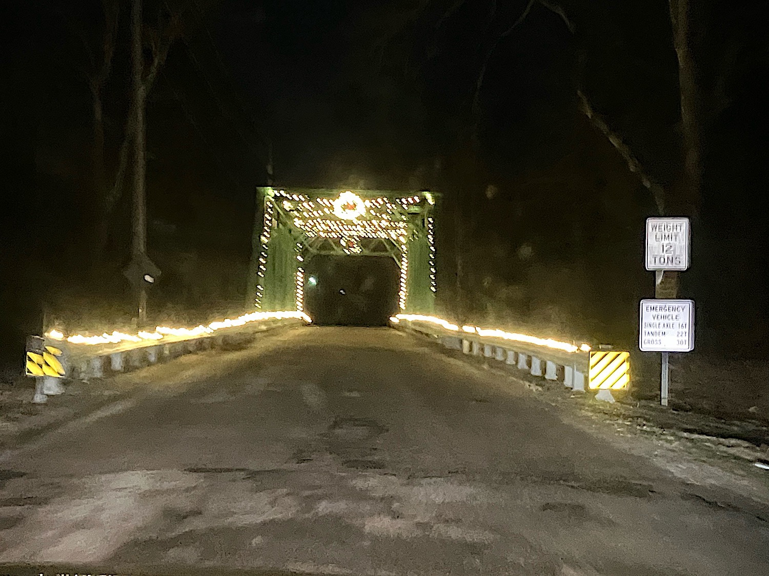
The road through the park crosses an old metal bridge, now festooned with lights that filled my heart with joy.
Solstice.
Now the sun will turn around
or so they said in the long ago.
Before it did I went to do my outside chores,
collected water, checked to see
if the bees were bundled enough, the sparrows fed.
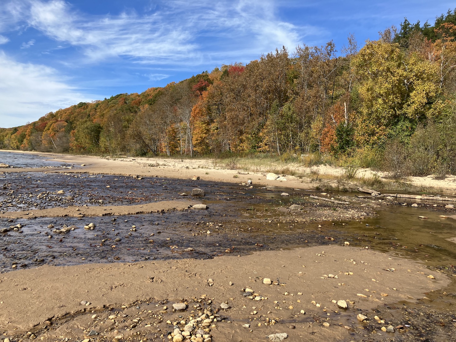
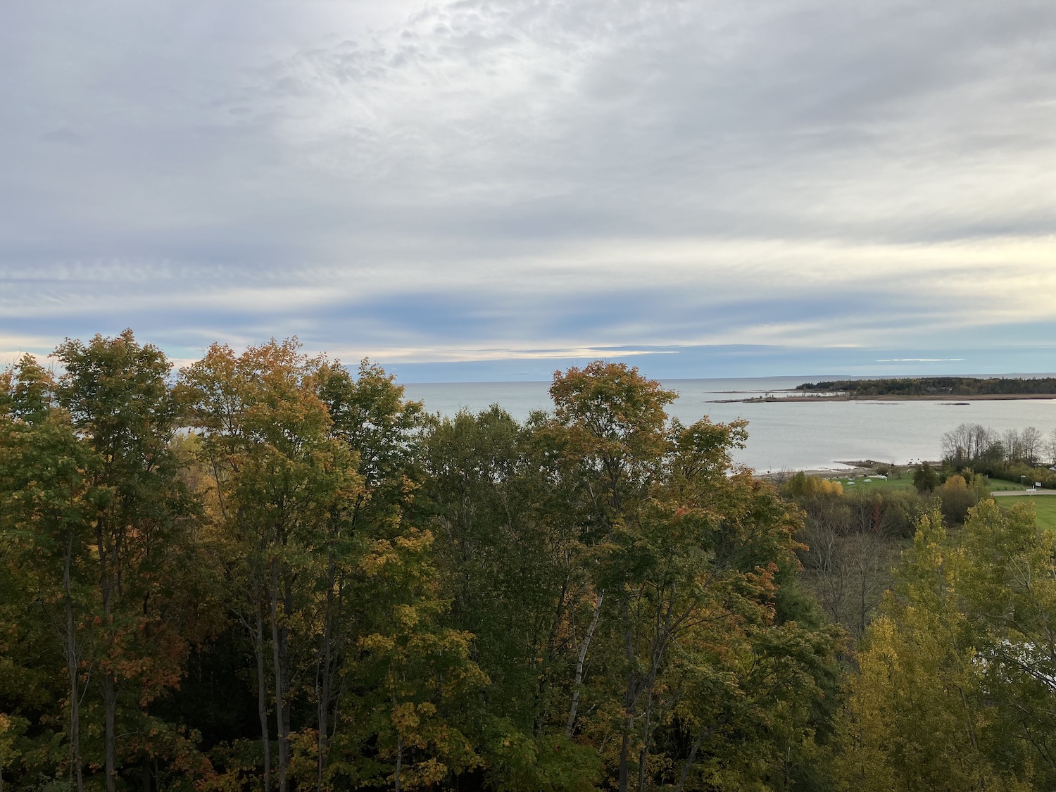
This year has been particularly mad with activity; fall, my favored travel time, arrived suddenly. I had longed to get up to the Straits (of Mackinac). Of course, the Island always waggles a beckoning finger, but I had hoped to return and explore Pictured Rocks National Lakeshore further, knowing it to be glorious from my one previous visit. No. Too many obligations, too little time. And so, traveling to the top of Lake Michigan and visiting some sites previously missed seemed to be a reasonable choice under the circumstances.
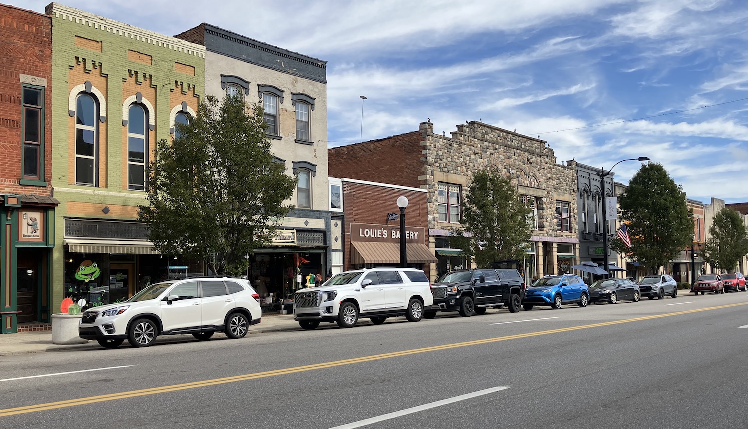
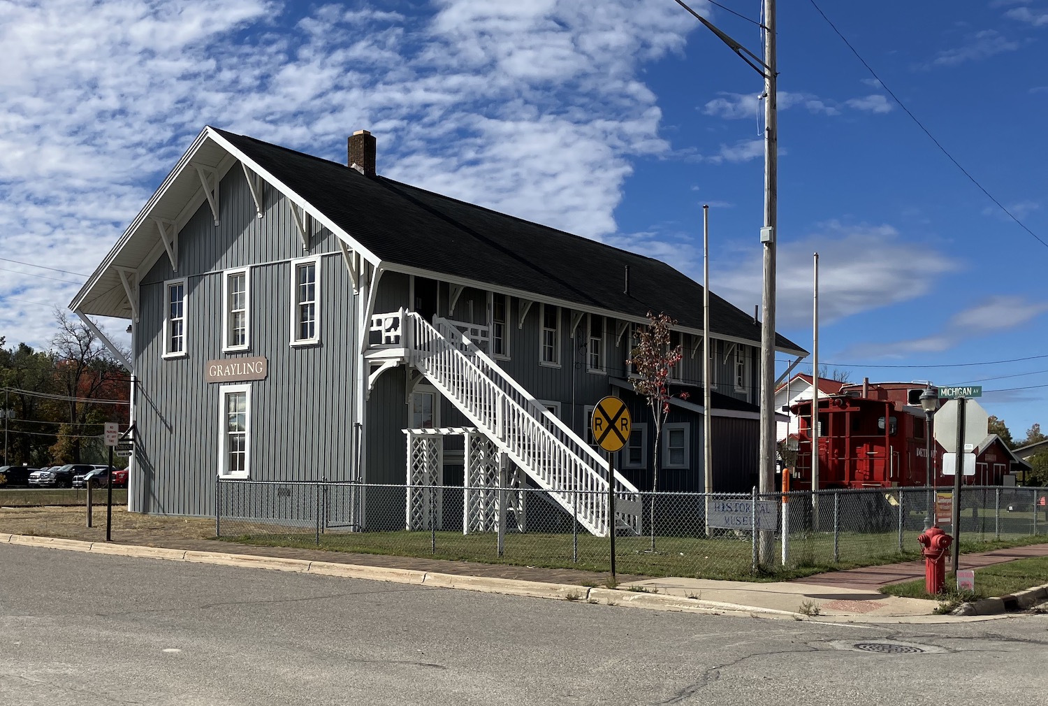
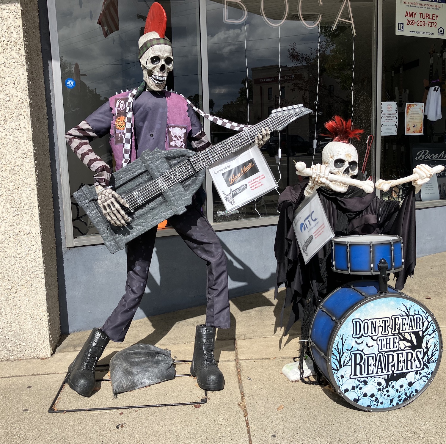
The drive up is long indeed, and over the years I’ve stopped for brief encounters with most of the towns along the way. But Marshall, my favorite Michigan town not on the Lake, is always a must. It’s especially fun now that this beautiful National Historic Landmark goes all out in October for Skeletonfest. I fell in love with Marshall years ago for its vast collection of 19th century buildings and intact streetscapes, not to mention its fascinating history, and the beautiful walks along the Kalamazoo River.
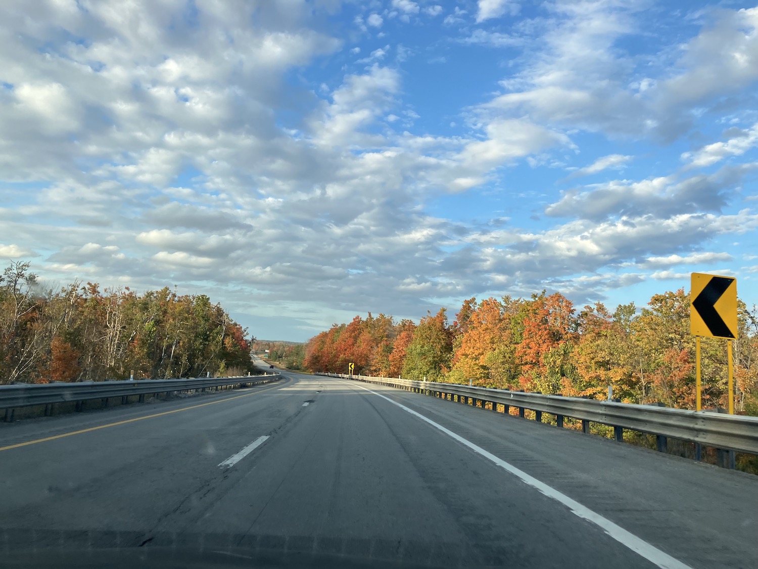
A quick and healthy lunch, a little walk, and northward bound! Fall began to jump out in earnest past Clare.
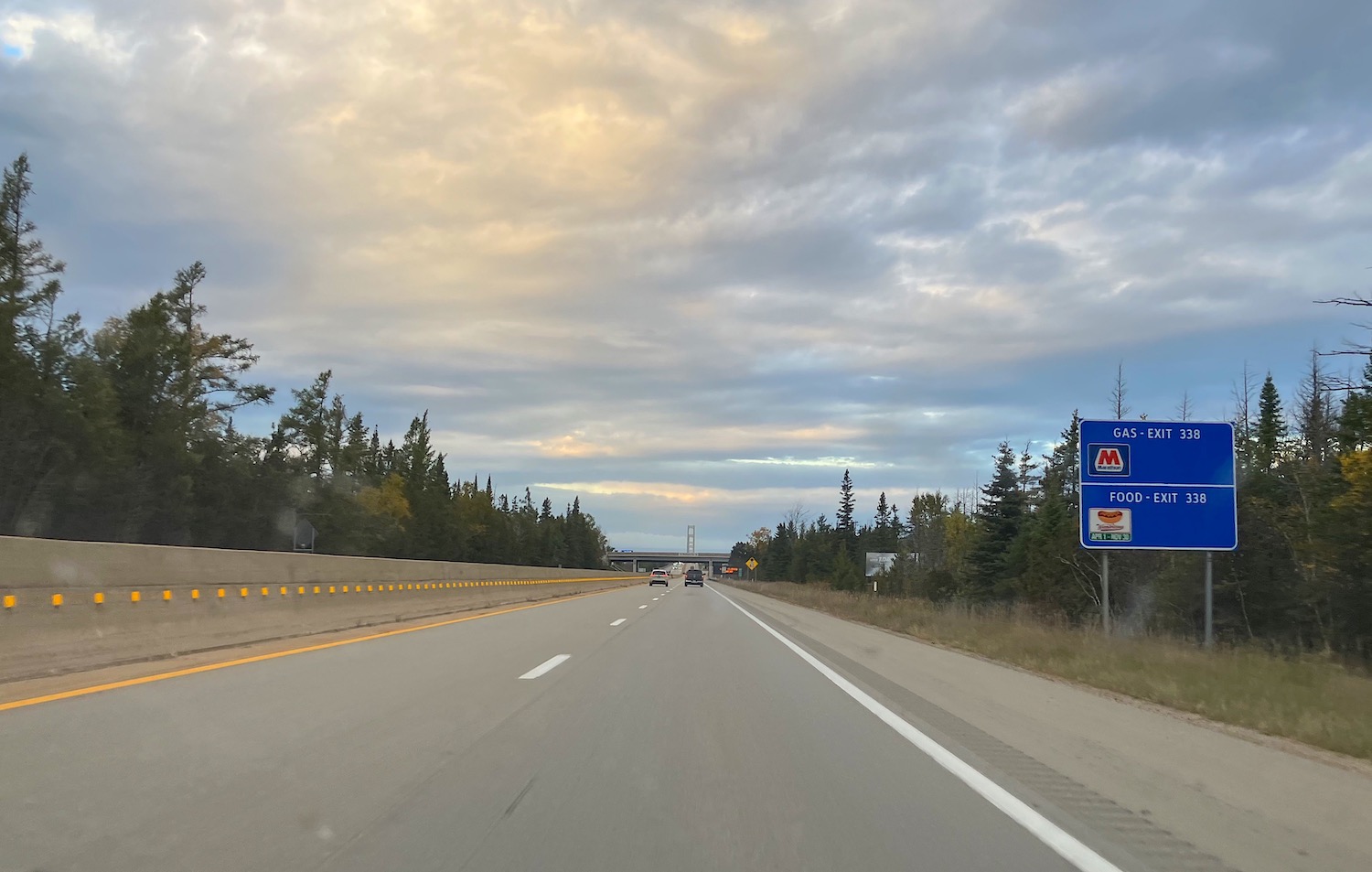
Eager to arrive, there were no more stops until. . . bridge in view!
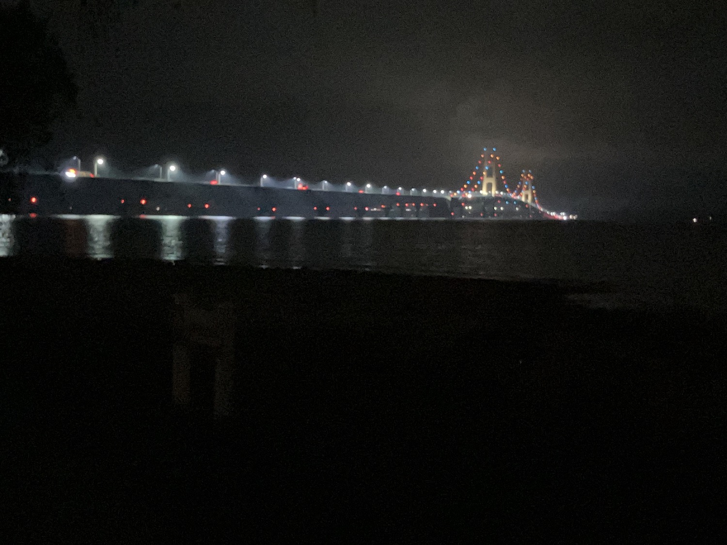
Had hoped to try a diner in Mackinaw City that I had missed in the past, but it was closed, so headed to another favorite. Delicious, but its prices had risen exponentially! Hard to be an independent business these days. Spent the night “in the shadow of the bridge”
and awakened to sunrise over the Straits.
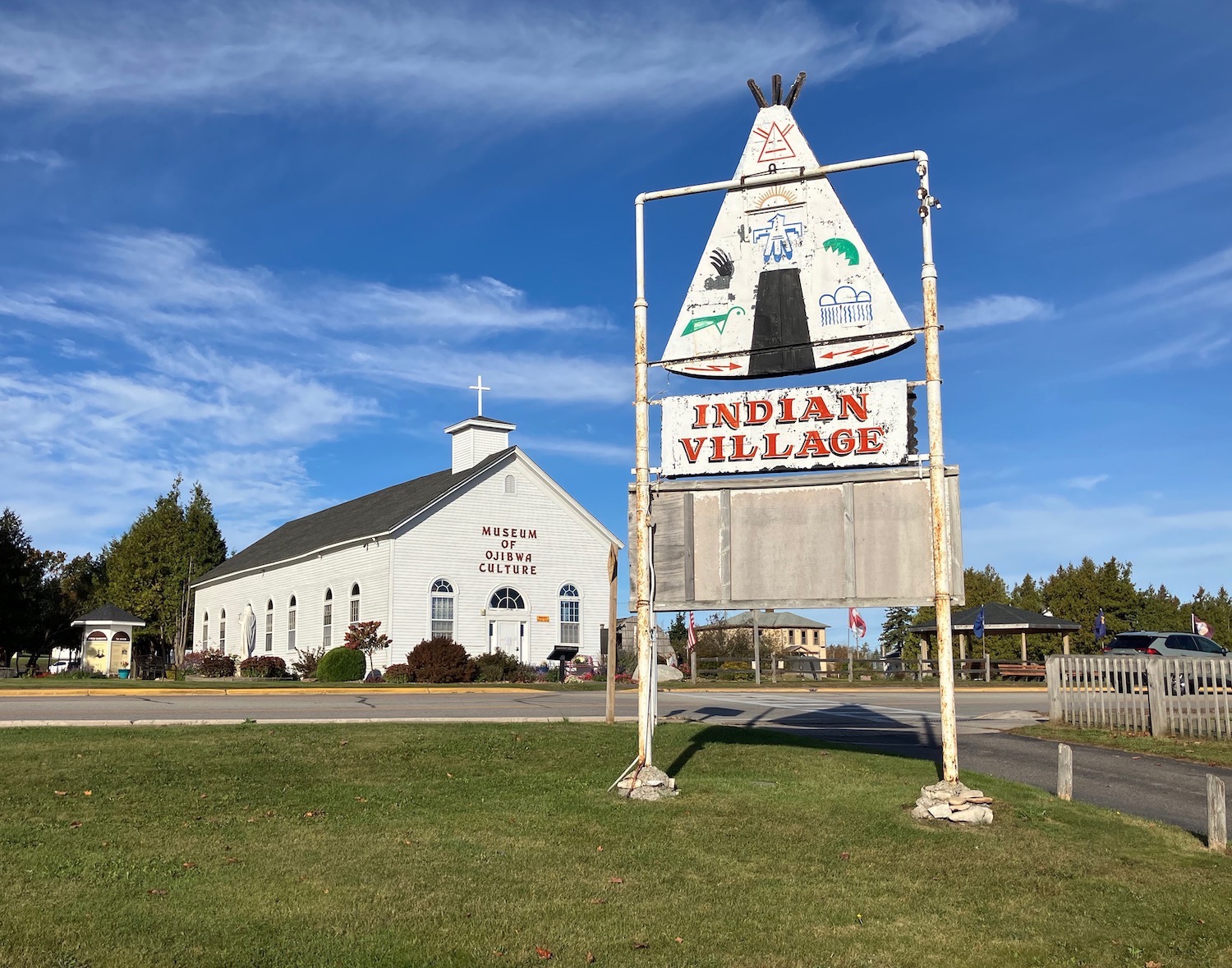
Across the Mighty Mac to St. Ignace, which seems to be doing better these days. A lot of the old cabins and motels that had been abandoned are now gone, but happily several remain and are doing business. The goofy “Indian Village” souvenir shop from my childhood is still going strong, ironically just across the street from the Museum of Ojibwa Culture (located in an 1837 mission building, a National Historic Landmark), which had only recently opened the last time I stopped.
Discovered a couple of New Deal buildings, too, much to my delight.
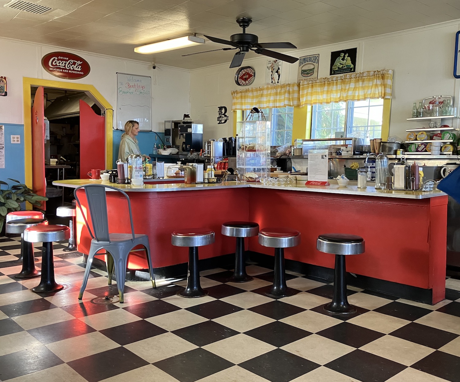
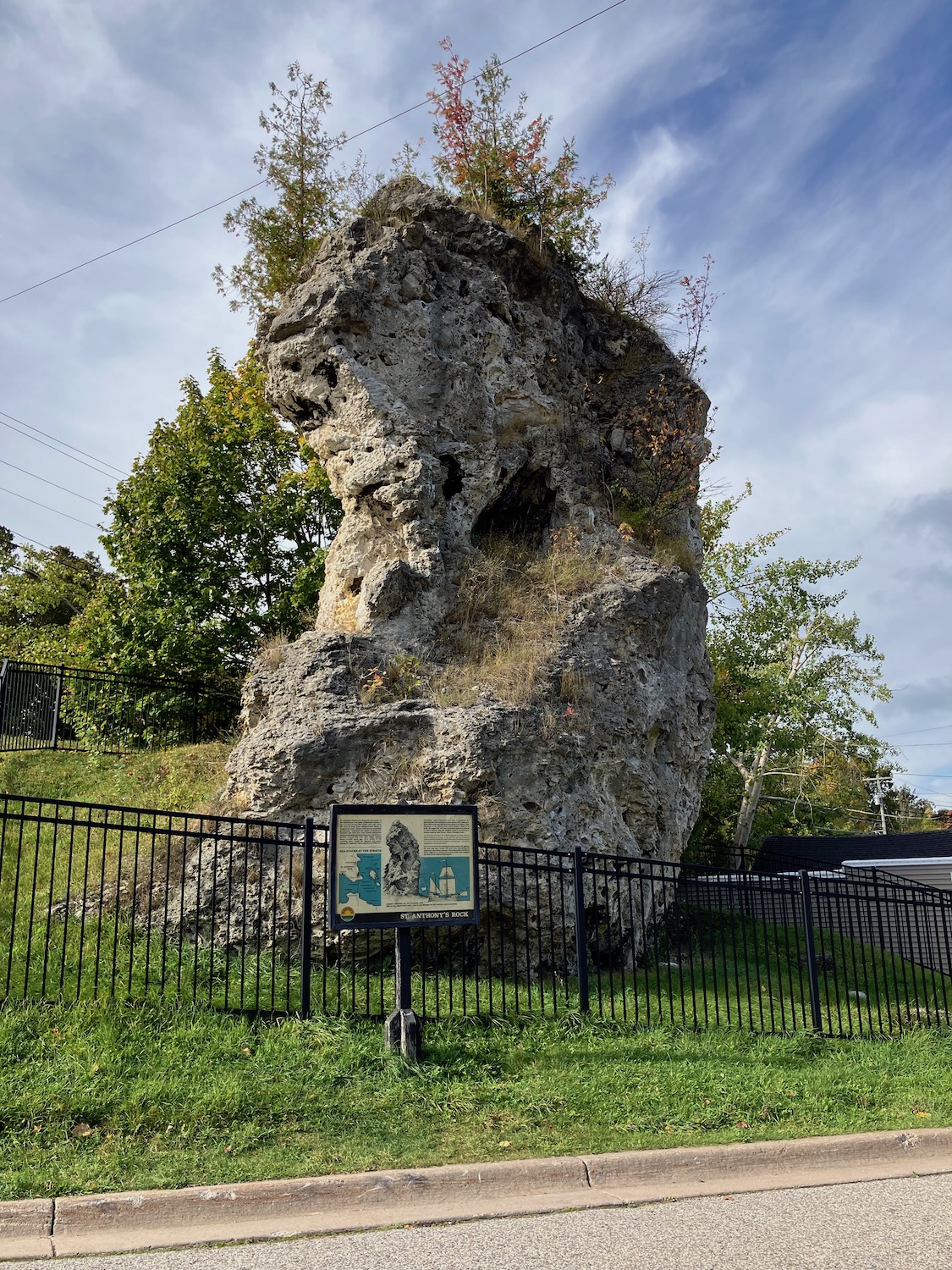
A perfect breakfast at Bentley’s Cafe, a 1940s relic playing early 60s tunes, then it was off to hug Lake Michigan on a perfect fall day, stopping to greet the geological wonder St. Anthony’s Rock, one of the many breccia (a type of limestone) formations called sea stacks in the area.
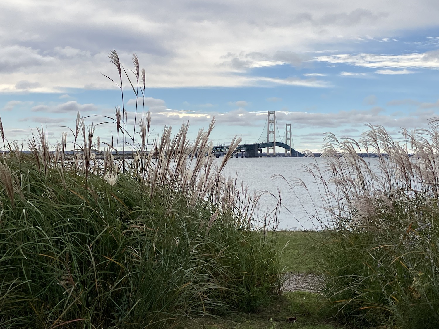
Stopped at the Bridge memorial
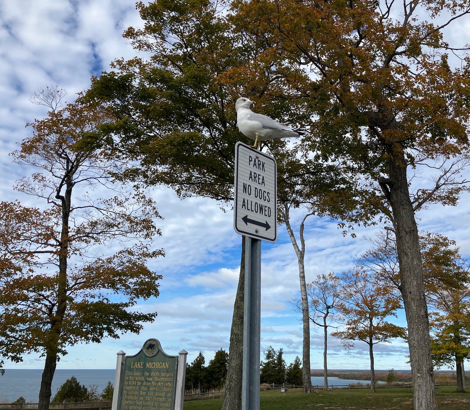
and a couple other stops overlooking the Lake
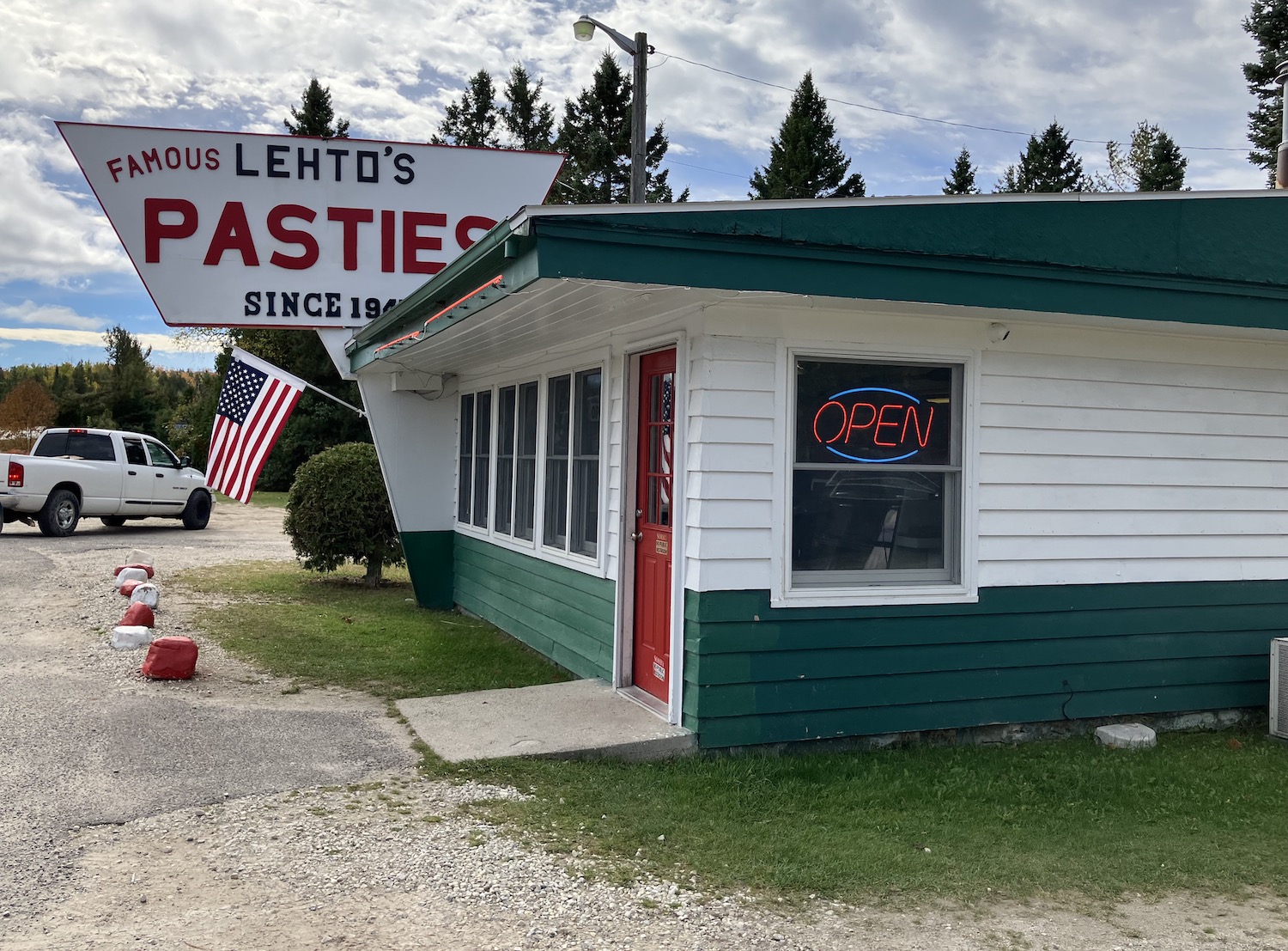
before pulling up to Lehto’s for one of the most delicious pasties in the UP. I had discovered this on my round-the-Lake trip three years ago, and my memory was true. Yum!
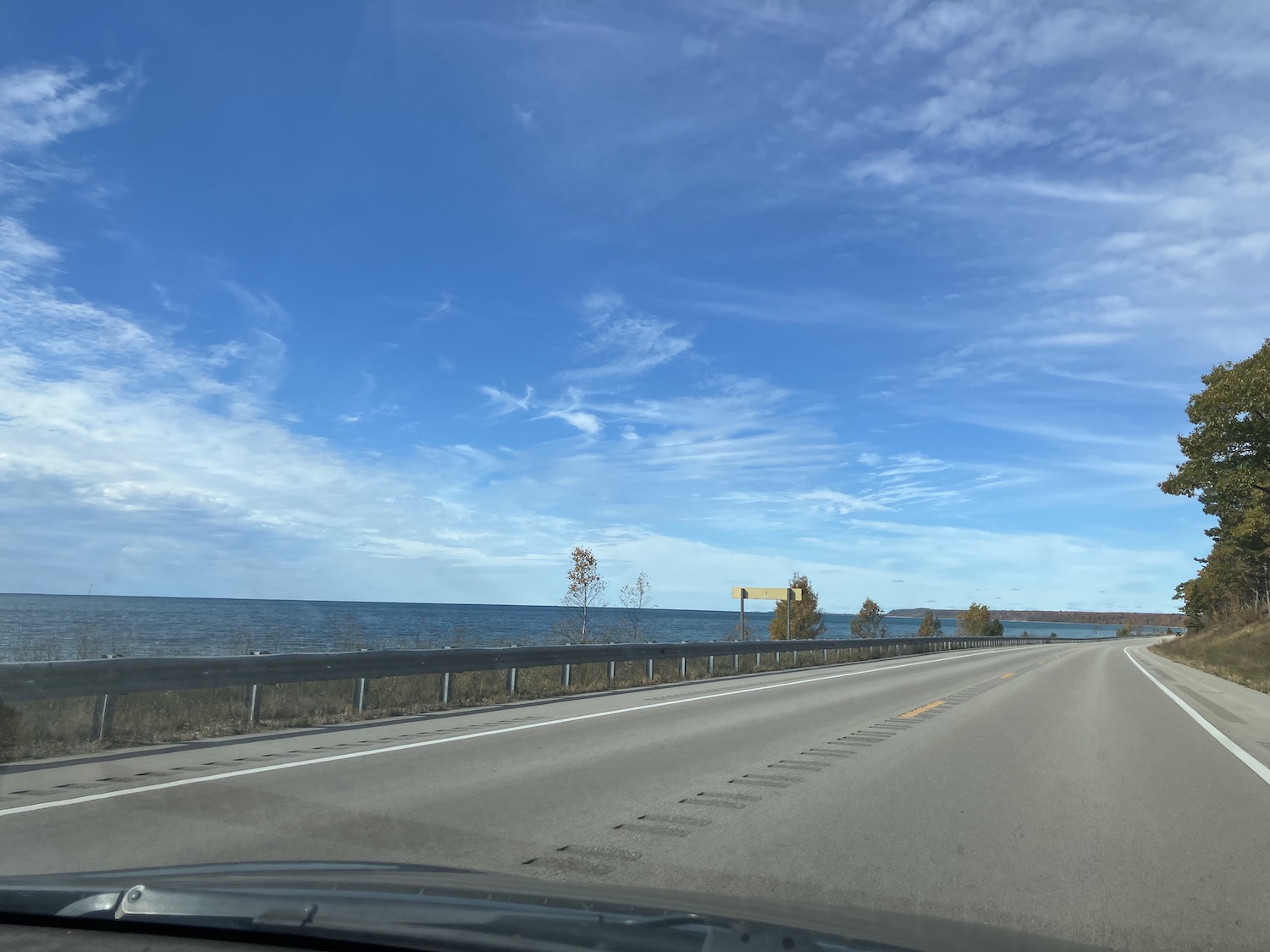
US2 runs so close to the Lake in spots that one might wonder if the waves ever inundate the road. It must be a fearful thing to drive during the gales of November!
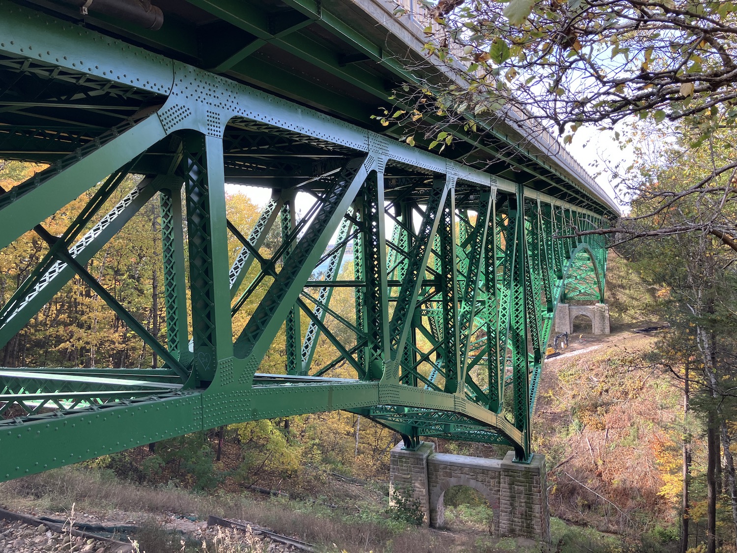
I’d read about an interesting bridge along this highway over the Cut River valley, a magnificent steel structure 647 feet long.
The roadside (bridgeside?) park is a popular hiking place, boasting a system of trails and stairs leading down to the river and Lake Michigan nearly 150 feet below. The scarlet and golden trees glowing in the brilliant autumn sun made it all the more magical.
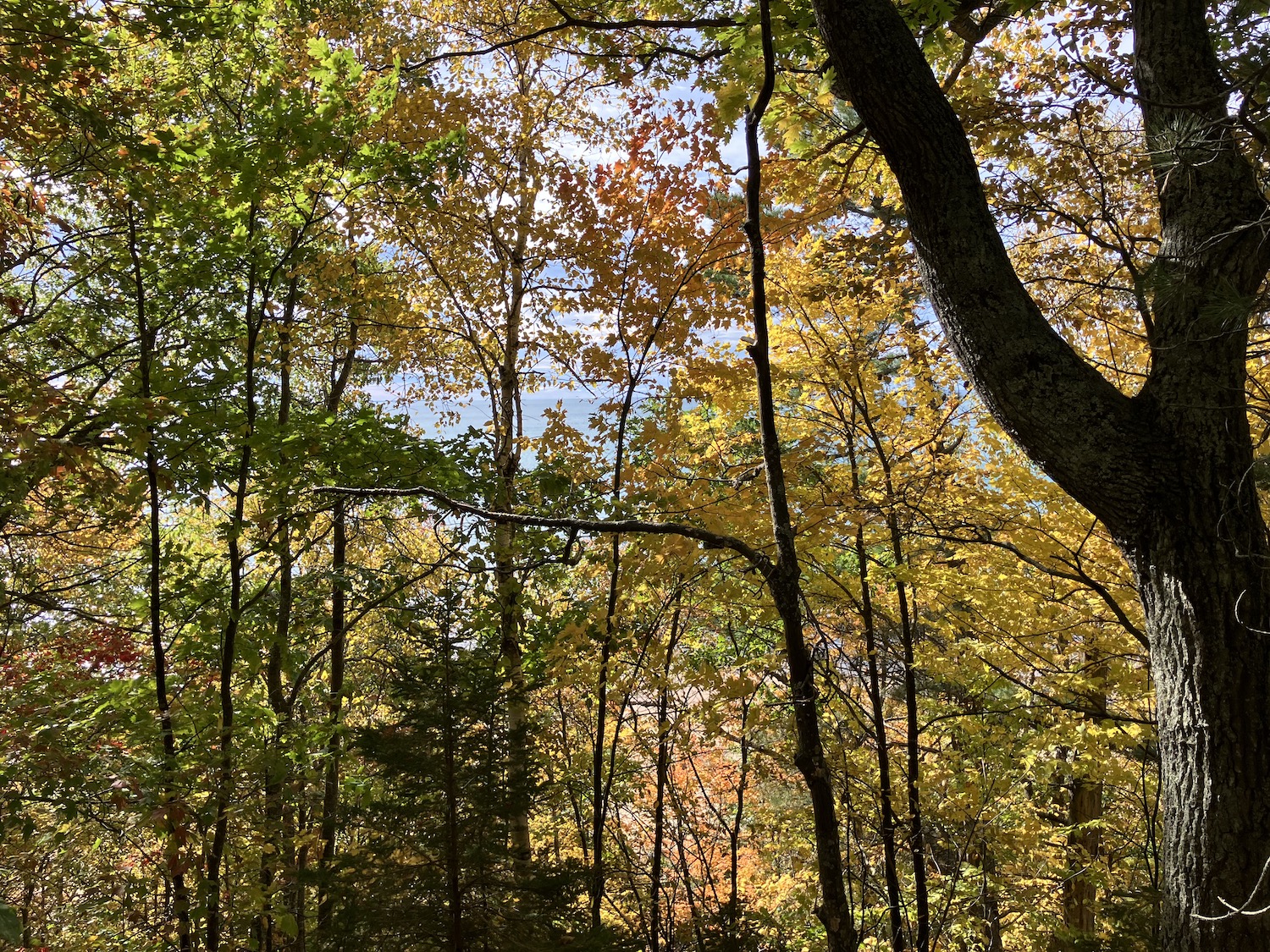
One eventually discovers the river is not very large at all, but it must have been very persistent over the centuries to create such a deep valley. At last the lake, brilliant with diamonds in the sun,
framed by autumn’s rich tapestries. A place to linger awhile–and then tackle the climb back!
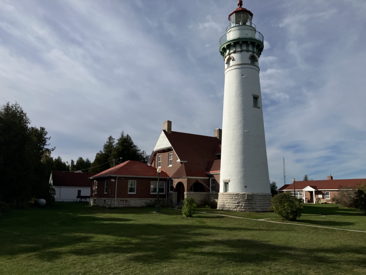
The highway veered away from Lake Michigan for several miles, and the landscape became less glorious, with wide expanses of forests that must have been burned over a few decades before. Had intended, more or less, to reach Manistique, but what with all the trysts with the Lake, the shadows were growing longer. A sign pointed to a historic lighthouse down a road I know I’d not traveled; after several miles and turns, the grounds of the Seul Choix Point Light appeared.
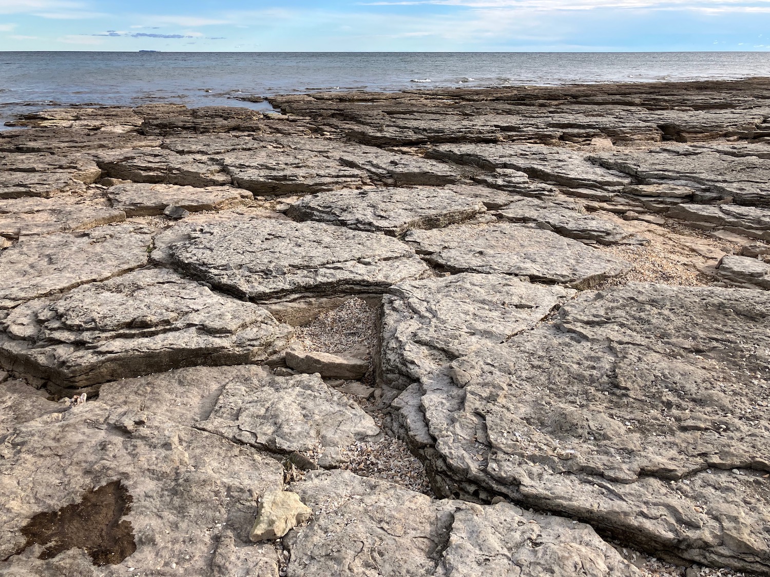
The lighthouse is beautiful and several historic outbuildings surround it. Built in the early 1890s, it is listed in the National Register of Historic Places. The Gulliver Historical Society is headquartered there. The lighthouse now lies some distance from the Lake but still is a functional navigational light, though automated today. The beach here was very different from all the others along the way, mostly rock of some limestone variety with large pockets of millions of tiny shells. What wonders to behold!
Back to St. Ignace, with beautiful views of the Lake and a lot of abandoned roadside architecture.
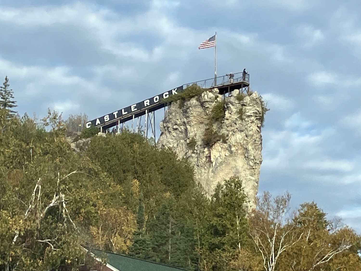
Supper at a well known truck stop, staying in St. Ignace for the night at a nondescript but cheap motel. In the morning, I had a yen to see Castle Rock, a nearly 200-foot sea stack that has been an area tourist attraction for around 100 years. I have climbed it, but not this day.
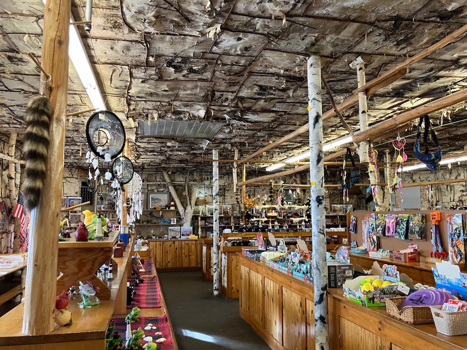
Did poke around in the wonderfully tacky souvenir shop, though, noting that some of the items have been on sale there for decades!
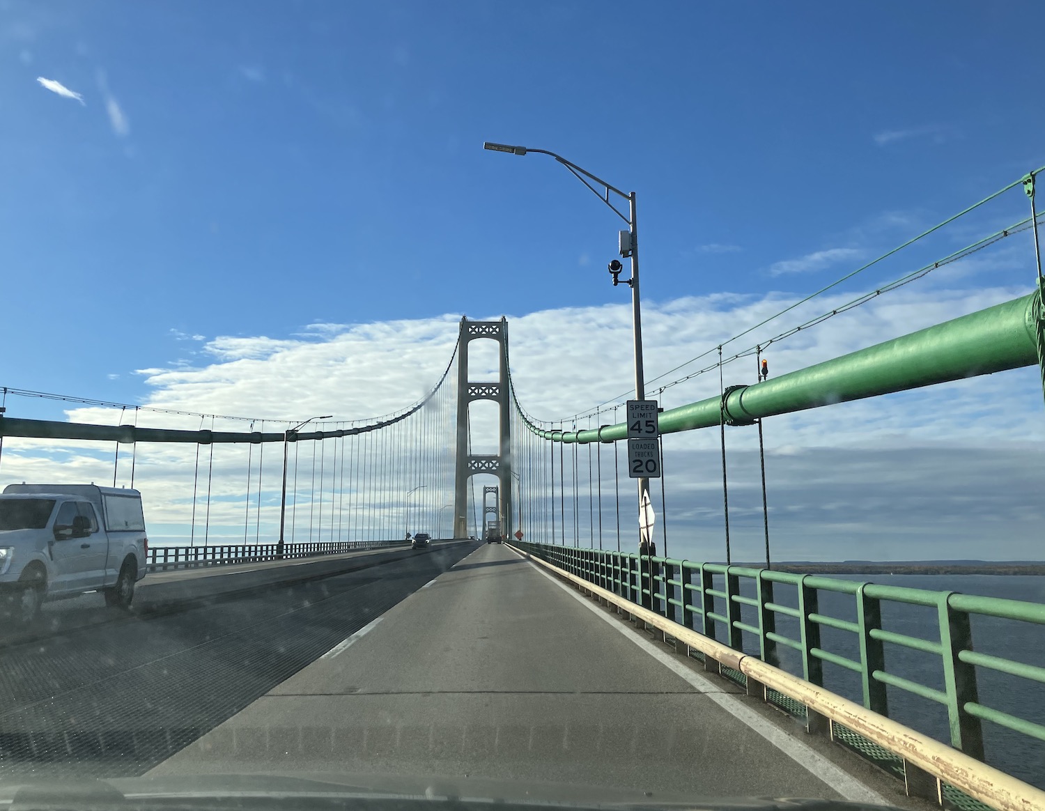
Crossing back over the Mighty Mac emphasized it was time to head back,
but did stop at the Mackinaw Bakery and wandered a little around the main part of town, stopping to say farewell to some of the locals. So hard to leave, especially on yet another perfect fall day.
Took time for a little stop at Grayling, a charming town about an hour south, home to another wonderful bakery. There seem to be quite a few artists in the area, the town’s vibe a bit more vibrant.
Ah, but miles to go. Barreled down all the way to Marshall before stopping for an early supper and walking among the skeletons again.
It is the 4th of July. Normally I fly an American flag that had belonged to my father, in part to honor him as much as to celebrate our country. Never one to flaunt his patriotism–he had shown it well enough serving six years in the Navy in World War II–he proudly displayed the flag on appropriate days: Memorial Day and the rest, certainly on the 4th of July. He was quiet in his pride at being an American and lived out his life as a good citizen. He was a Civil Defense volunteer in the 50s, because folks in the area came and asked him, and he thought it was the right thing to do. My dad was a natural leader who never sought be. He saw what needed to be done and did it. He was the best kind of American: responsible, caring, present.
This country has turned down a dark path. Many of us intend to go on caring and to resist the hatred and hateful policies that surround us, and, be assured, affect us ALL.
I’m not sure what my father would do. He has been gone for over forty years and could not possibly have foreseen these frightening dark days that have arisen from within, not from an outside enemy. I hope he would not mind that today I do not fly the flag. Instead I join a peaceful group in community to celebrate our freedom to which we cling tenaciously and to commemorate those flawed men who got it all started in 1776. My father fought for my right to do so.
By the way, here are my dad’s medals attesting to his service. He did not care about them, but my mother nonetheless displayed them in a back room in our house, and they ultimately came to me. I show them proudly.
So, freely and without irony, happy birthday to the United States of America, I fervently wish we have many more as the free and democratic nation we ever strive to be.
America! America! God mend thine every flaw, Confirm thy soul in self-control, Thy liberty in law!
As befits the first day of summer, I suppose, today has begun a horrific heat wave. A friend invited me to a solstice yoga event and I had planned to go, but instead I decided to dwell awhile longer in the dark–that is, to contemplate last night’s wondrous dance among the fireflies that culminated in solstice, right around 10:30pm.
It is always a good day when I can include the Lake to celebrate. Save the Dunes, an organization of which I have been a member since my twenties, was celebrating its 73rd anniversary at its headquarters in Michigan City, and so I decided to attend and incorporate a few errands into my trip. It is always stimulating and strengthening to gather with folks who are all fighting the good fight to work with, not against, nature.
After the gathering, I sought out the Lake and headed westward into what is now the National Park. Sadly, I quickly noted considerable evidence of the recent funding cutbacks: ugly porta-potties set up to replace the sturdier and more pleasant restroom building, now locked. Nor was there a lifeguard at the beach. I had never visited this particular beach; it was a fairly long walk to the Lake from the parking lot, the road lined with a myriad of native plants, several in full flower.
I remained atop the final dune rather than descending to the shore; the sun was hot and the trudge back up did not appeal to me. But I sat a good while, contemplating the quiet waves. Glancing eastward I was surprised to see the ubiquitous cooling tower of Michigan City’s power plant. Yet here in stark contrast was a lovely duneland, with trails through the woods and plenty of wildlife to keep one company. A small lizard skittered across my path, and butterflies danced among the wildflowers. Sand filled my shoes–and peace filled my soul. The Lake, always.
After a quick stop in my hometown, I headed back, with plans for the remainder of my solstice celebration. There is a magic place I know, surrounded by a city, that I discovered years ago and have shared with but a few. It is a place of peace and quiet (for it is easy to ignore the outside din there) and wonder at any time, but at this particular season, it is filled with fireflies, thousands of fireflies! Although pitch dark, light was everywhere. The paths through the enchanted woods were lined with fireflies on either side and on the ground and far up into the trees. They flashed and darted; I could hear faint echoes of Mendelssohn’s “Midsummer Night’s Dream.” I could not help but dance, then sat upon a bench, enraptured. Welcome, summer solstice. My heart is full.
Mackinac Island is a special place, beyond the fudge and the Grand Hotel (although those add to its joy), to be avoided in the summer months overrun with mobs of tourists. May on the Island is lovely and fresh, but I recalled autumnal joys and wanted to experience those again after many years.
Headed up through the middle of the state with a stop in Marshall, still my favorite Michigan town not on the Lake. They were in the middle of SkeletonFest, a month-long celebration of Halloween, and every business has some sort of skeleton in costume or other spooky tableau. Visited the wonderful New Story bookstore, Grandma’s Toys & Treats just for fun (and a Triceratops ring–if you have to ask. . .) and enjoyed a nice coffeehouse lunch. Ah, but so many miles to go! Up and around Lansing, then a straight shot north on Highway 127. The terrain gets hillier after awhile, the trees less deciduous. Beautiful. Clare, Grayling, Gaylord–been through all at one time or another. Stopped just to walk around at a beautiful roadside park north of Gaylord and greeted autumn.
Then onward until. . . Mighty Mac in sight!
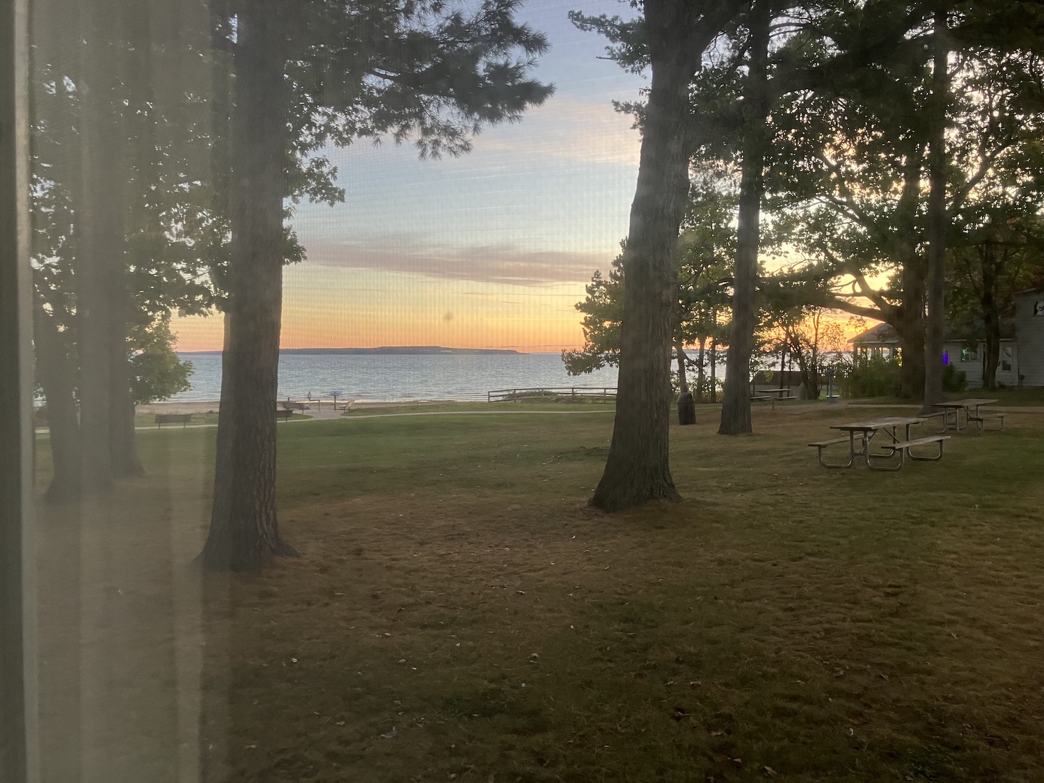
Mackinaw City was a tiny tacky tourist town–but not without a certain charm–when I first began coming up here so many years ago. Now it is a much larger tourist trap that has spread westward and southward, well peppered with chain hotels and restaurants. As usual I ignored these and headed to a motel in which I’d always dreamed of staying. Turned out not to be expensive as I’d supposed, despite its prime location practically under the Mackinac Bridge! Comfortable and cozy, the Riviera Motel, probably dating to 1960 or so, lies sandwiched between the town beach to the east and the state park to the west. I hope they are not going anywhere soon. Checked in and went out walking in the night, alone with the Lake–or more accurately, the Straits–and that big beautiful bridge.
With morning had come rain but already diminishing, and a fabulous breakfast at Darrow’s, a family restaurant at the west end of Mackinaw City that has been there forever–or at least since 1957. I remember eating there with my mom some 30-odd years ago. Busy, cheery, a place where the waitresses call you “honey.” And that’s just fine with me. The eggs were so fresh it seemed they must have been gathered that morning.
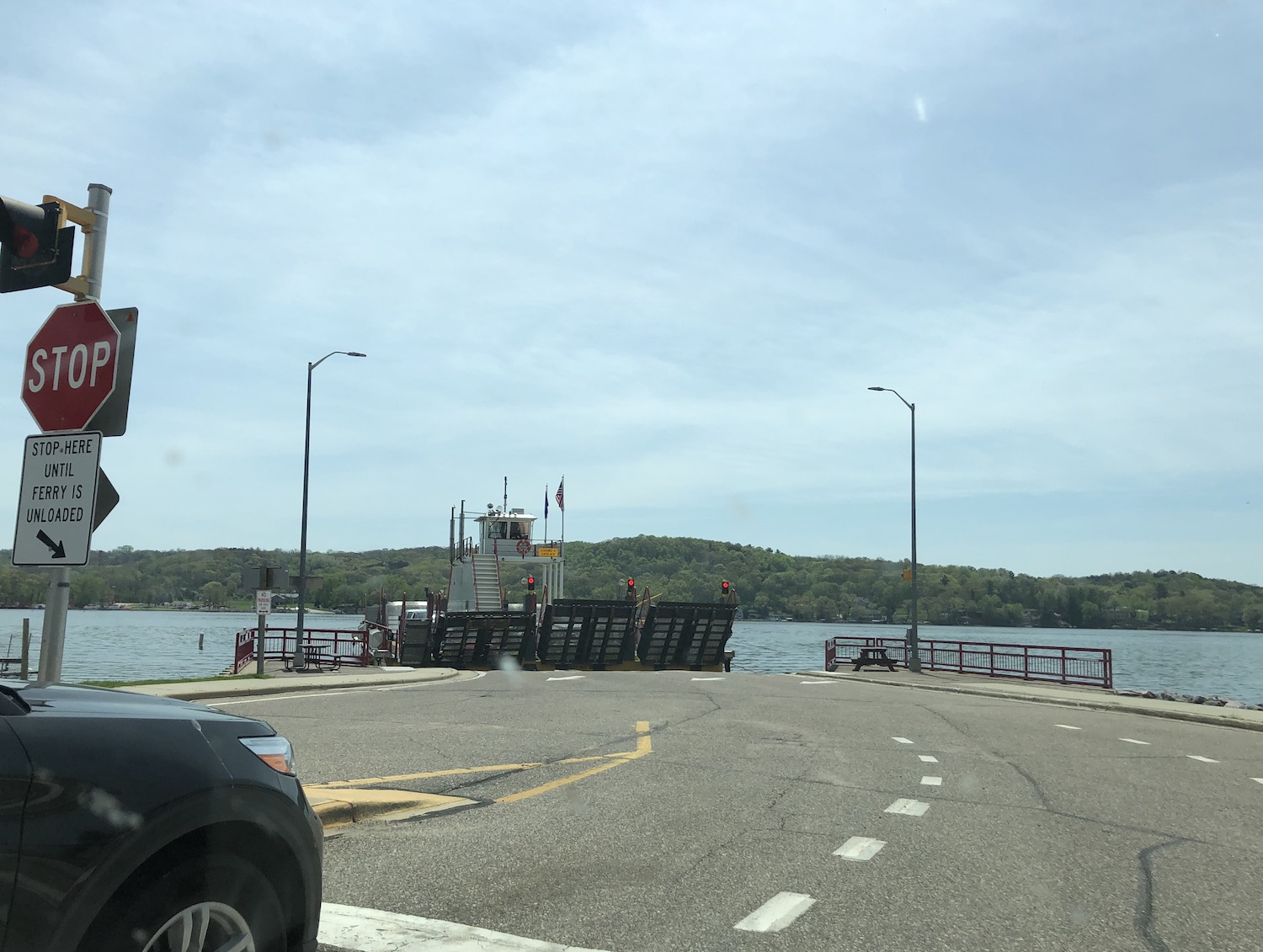
Then it was off to the ferry! There is now only one company, after years when one could choose from three different ferries. Happily, there was scarcely any wait since they were running every fifteen minutes even this late in the season. It is still Shepler’s now, but a name change goes into effect next year.
I sat on the top deck to catch earliest glimpses of the Island’s landmarks I know so well, an invigorating crossing as the sun slowly broke through the clouds, highlighting the Mighty Mac and the Grand Hotel. What a joy to see it all again! The day was fresh and breezy; the main street was bustling but not overly crowded. I had found booking accommodations on the Island surprisingly difficult this time; it would seem October is no longer “off season” and prices in general had risen considerably. At the lower end of the main street, the bright yellow Windermere Hotel, originally built as a family “cottage” but converted to a hotel in 1904, was a place I had always wanted to try. The location is lovely–happily, close to the ferry dock–and overlooks the beach adjacent to the library.
Oh, with what to begin? The Lake, of course, then horses, some close encounter of the equine kind. Driving a small carriage past the Grand Hotel and through the woods is such a joy. As a child I had learned to ride on draft horses, my ankles barely dangling over their sides; how I love these beautiful creatures.
The day was so lovely, what next? Food on the Island is pricey, but some places less than others, usually the establishments that don’t sell liquor. A walk along the length of the street, admiring the buildings (closing my eyes to the tacky tourist t-shirts and souvenirs) and visiting
the recreated missionary bark chapel at the foot of the Fort, across from the historic Trinity Episcopal Church. SO much history here!
Following the endless flowers, which on the Island are larger and brighter than anywhere else, I walked on to Ste. Anne’s, the storied parish church; the current building dates to 1878. How glorious it stood in the autumn sun! A slow walk back to the hotel, reveling in Island time.
The next morning, just as gloriously sunny, there was time for a walk along the Lake, admiring the giant rosehips–and a few late blossoms–that thrive in this environment, along with the late
nineteenth century cottages, most of which are still privately owned. I noticed a few were already wrapped up to get through the harsh winter ahead. A few minutes relaxing on the Windermere’s porch, then off to the ferry, as always with a little sense of loss, but with more Michigan adventures to come!
I never leave Mackinaw City without stopping at the bakery, sometimes for lunch, sometimes just to get some yummies for the road. It was so crowded that lunch was not an option, so it was back to Darrow’s, an excellent choice for lunch as well.
Headed down old 31 to Petoskey to meet with the folks from Freshwater Future, a nonprofit whose mission is clean water and water justice in the Great Lakes region. Good people! We talked long and laughed a lot.
With a brief Lake encounter near Charlevoix, it was on to the charming town of Frankfort for the night, just in time for sunset.
The motel was one built in the 1950s, jazzed up with some retro fittings and higher-priced charm. Comfortable enough.
In the morning it was back to the beach to greet the Lake and the lighthouse (a campaign is underway to restore it), then breakfast in tiny Elberta in a cafe beloved by the locals.
How lovely it was, meandering through the beautiful rolling orchards and fields toward Pentwater, but dismaying to find the road south closed.
Still, eventually made it to Mears and beyond to Cherry Point, always a must stop. Proprietor and noted regional author Barbara E. Bull, with whom I have been acquainted for some decades now (!) was not in, but I hope to catch her later this year. As always, I picked up some of their very special trail mix and a couple of (mmm!) cherry turnovers.
Then another 20 miles or south for lunch in Montague at Lipka’s, run by the pharmacist’s daughter. Again, another must stop for decades, this cafe was once a drugstore owned by the proprietor’s father. She kept the soda fountain and many of the old drugstore items are on display. Great food, and definitely the best ice cream sodas in Michigan.
275 miles from home, southward bound, with a stop at Dee’s Farm Market, of course, for mums and apples and a pumpkin. One more stop to say farewell to the Lake until we meet again.
Mind you, I did not even realize this beautiful wild creature had a name, but apparently he’d been christened “Charles” by the local populace. I’d simply admired him for many years. At first my sightings of him were relatively rare, but more and more he spent time in areas where people frequented, and over time there were more and more of them invading his space. His downfall, ultimately.
I have visited Falls Park for many years, initially when seeking out New Deal-built improvements to this lovely wooded area on the edge of Fall Creek. At that time it was just the main park, with its pond (a former quarry), playground, picnic shelters, and the banks of Fall Creek. Beyond that creek to the northeast was an abandoned railroad right-of-way that I explored a time or two; it was intriguing but tangled and overgrown. A few years went by until I returned to the park, and to my delight, that interesting area had been turned into a system of trails, so the park became a favorite nearby place to get away into the woods. But sometimes, there would be a heron patiently stalking the fish in the creek, a glorious sight.
Not that long ago, heron sightings were rare, especially in populated areas. But like many creatures of the wild, their habitat is increasingly reduced, so they must adapt or perish. In more recent years, it had become rare not to see the heron––actually, two, presumably a mated pair, seldom seen together, but occasionally one would be fishing in the creek while the other stood looking majestic on the edge of the pond. One was slightly smaller than the other, but it was really difficult to tell which was which upon spotting just one, especially at a distance. And they did keep at a distance, as I learned one day as I crept closer to secure a good photograph. Evidently I crossed a line only the heron knew, for he took off across the creek with a horrendous “gaaaaaaaack” worthy of his dinosaur ancestors. It was the first time I had ever heard any noise from a heron, and it was startling and wonderful at the same time.
Falls Park is popular with anglers. Spring, summer, fall there are always a few diehard fisher people, both in the pond and along the creek, especially below the dam–where the heron often fished. More kept flocking to the park; the banks became crowded with them. Despite posted signs, many waded into the water casting their lines, and more and more often we’d find tangled line, broken bobbers, discarded bait, and lures–hooks intact–along the banks. Inconsiderate jerks, I muttered as I gathered up what I could. This came to a head a few years ago when I discovered a distraught mother duck struggling with her baby who had a foot enwrapped in fishline. I carefully cradled the duckling and tried to remove the tightly wound line but could not get it all. I called out to the people nearby who were doing nothing, asking if any had a knife. One did, and I was able to cut the line and free the baby.
More fisherfolk kept coming to the park, not all of them thoughtless, I trusted. Some cast their lines dangerously close to the heron, who often stood beside the spillway, snatching and swallowing fish after fish, far more successful than his human competitors. But still, one could get only so close until he would fly off, sometimes quietly, sometimes with a cry of avian defiance.
But a year ago I spotted him on a tiny island–one often inundated after heavy rains–and I was able to get closer than usual. The reason became clear; he had a hook attached to a lure lodged in his foot. I was horrified. Evidently others were too; Hoosier Wildlife Rescue and Rehabilitation (an organization of which I had been unaware) received numerous calls, but the heron was wily and would not be caught. I still saw him often over the last year. He survived the winter still dragging the painful burden, which over time, apparently hooked onto more dangerous discards. His movements were hampered and his ability to fish compromised. Line had caught in his wing. At last the wildlife rescuers were able to capture him and begin efforts to repair the wounds and restore him to health, but it was too late. Worn and emaciated, he died despite their best efforts. I learned of it last week.
I was so upset, so furious, so angry with thoughtless, selfish humans I fired off a scathing Facebook post about it. Littering is not just unsightly, it can be dangerous to wildlife. And this went beyond littering. I went on and on about the insensitivity and carelessness of these people who think of nothing but themselves and leave a mess behind. Oh, I ranted and raved, but evidently hit the wrong thing, and the entire post disappeared. I dissolved into tears and could not recapture the fury–nor the words. Nature can be cruel; the heron could have been the victim of a predator or age or lack of food, but no, stupid humans, interested only in their pastime, caring nothing for the effects on any other living thing (including fellow humans) directly caused his death. And that is wrong. We all should mourn–and remember.
The madness was increasing, the pressure growing. No time, no time, and I had been hearing the clarion for weeks. I had not seen the Lake in too long. There was a little space of time to get away between too many projects, no matter what, no matter the emergency oral surgery the very morning of departure!
Being with the Lake remained the priority. Just a couple of days, but oh! Two magnificent sunsets, two early mornings! (I do not do sunrises. Indeed, only the Lake can rouse me out of bed.)
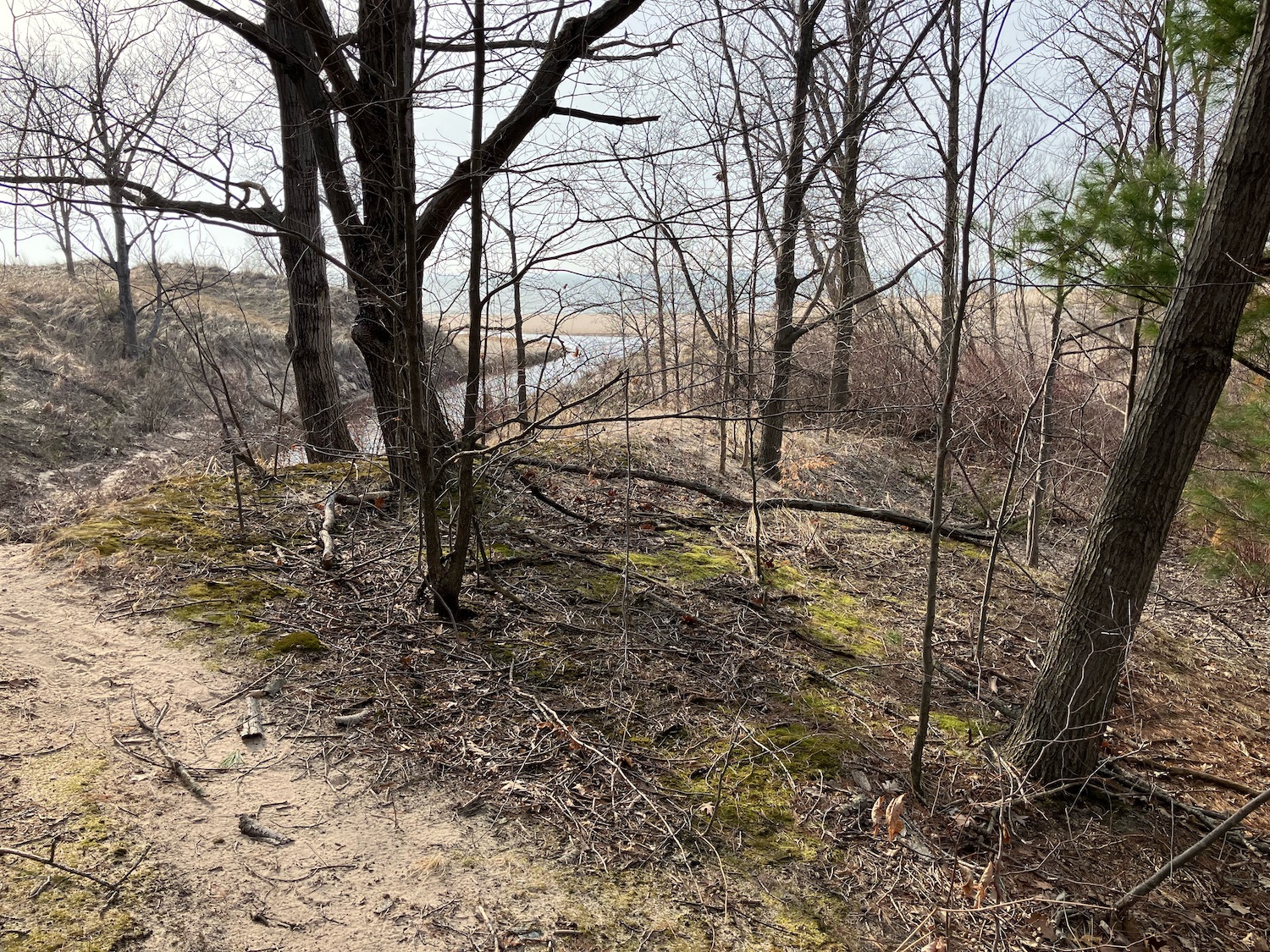
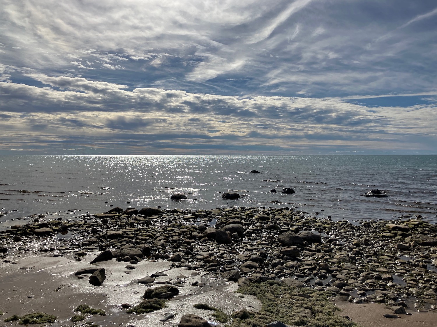
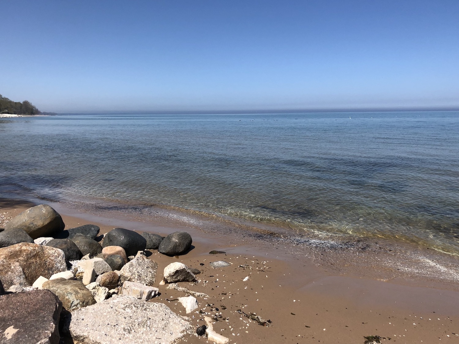
Always the Lake. This time I stayed close to the border, within 20 miles of where I grew up, at a secluded historic inn. The Lake was just across the road, straight down very long wooden stairs. At long last! The glaring sun cast long shadows–still April after all, but with the trees all leafing out, probably still as confused as I. The waves were quiet and gentle, but soothing all the same. I lingered until the sunset, marveling at the patterns in the sand and the stones that jumped into my pockets.
I had not slept so well in ages. I arose early to a joyous cacophony of birdsong and woodpecker hammering, and headed outside after a quick cup of coffee in the lobby. Sitting on the long porch and writing was tempting, too, but the Lake’s siren call was irresistable.
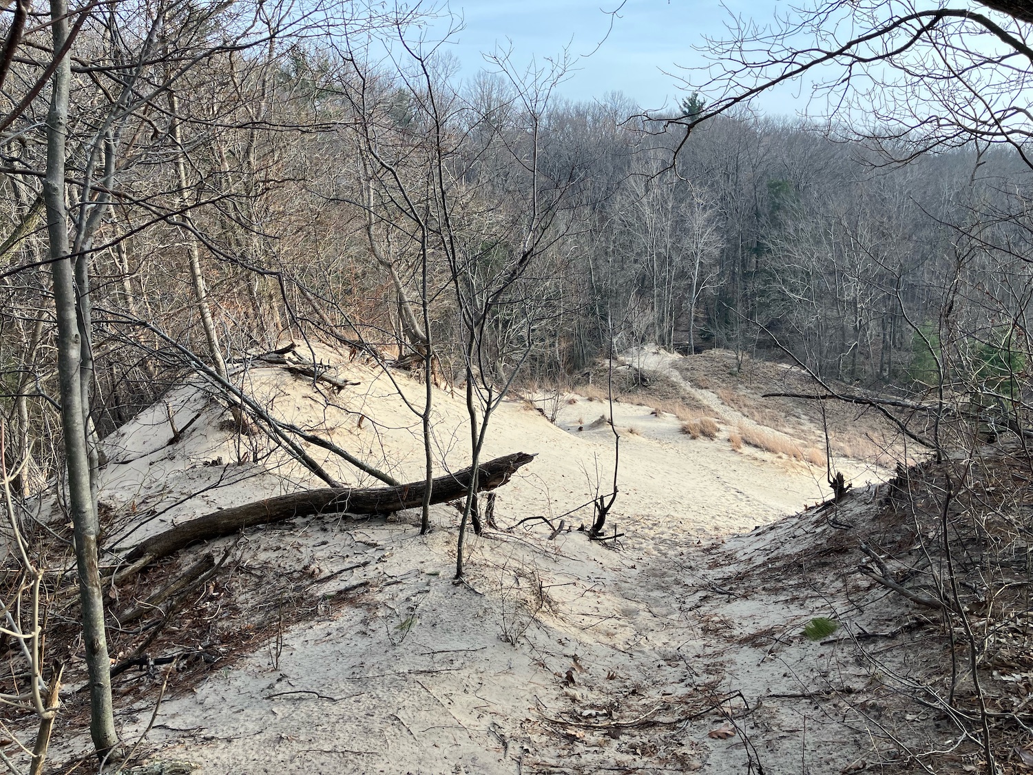
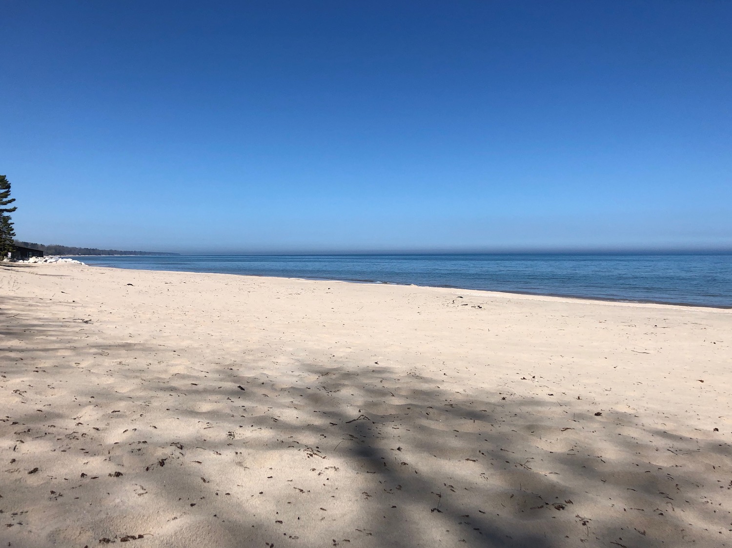
135 steps down, give or take. And that’s just from the road. The inn is on top of the dune–yes, this is all duneland here. The Lake was quiet, the waves a bit more energetic than the night before. I walked a good way along the shore, past deserted little cottages, and a shimmer of buildings on the horizon that must have been Chicago. More stones leaped into my bag; I walked, I danced!
I stopped to accept the Lake’s caress, leaning into the breezes playing about my hair. Oh, the wonder, the Presence, the Being Present! All so intermingled that I was barely aware–it just was: the Lake, the wind, the glorious day, all One.
Back up those steps to the Inn with the object of heading northward a ways to Glenn, where I’d hoped to have breakfast at the old restaurant where the town’s nickname of Pancake Town, seemingly now forgotten, originated. What is today Blue Star Highway was once the main road, US31, along the Lake, and in 1937, a blizzard stranded scores of tourists for three days. Food supplies ran out, all except a recent shipment of pancake flour, so that’s what everyone ate. For several years after, the town held an annual pancake festival. The restaurant has changed hands numerous times since I discovered it many years ago, then still a roadside diner and community gathering place. Some subsequent owners tried to make it more upscale, but they never seemed to last long. Alas for this trip: apparently new folks have once again taken ownership, but they were not opening until the following week. So, it was back to South Haven for lunch, but first a stop just a little beyond Glenn to see the matriarch of Dee’s Lakeshore Farm.
I have written much of Dee, at whose farm market and secondhand shop I’ve stopped for at least thirty years. How saddened I was to learn her husband had only just died the previous week, but there she was in business. She loves people (and they love her); it keeps her going. At 89, she’s a delight, and she is tough.
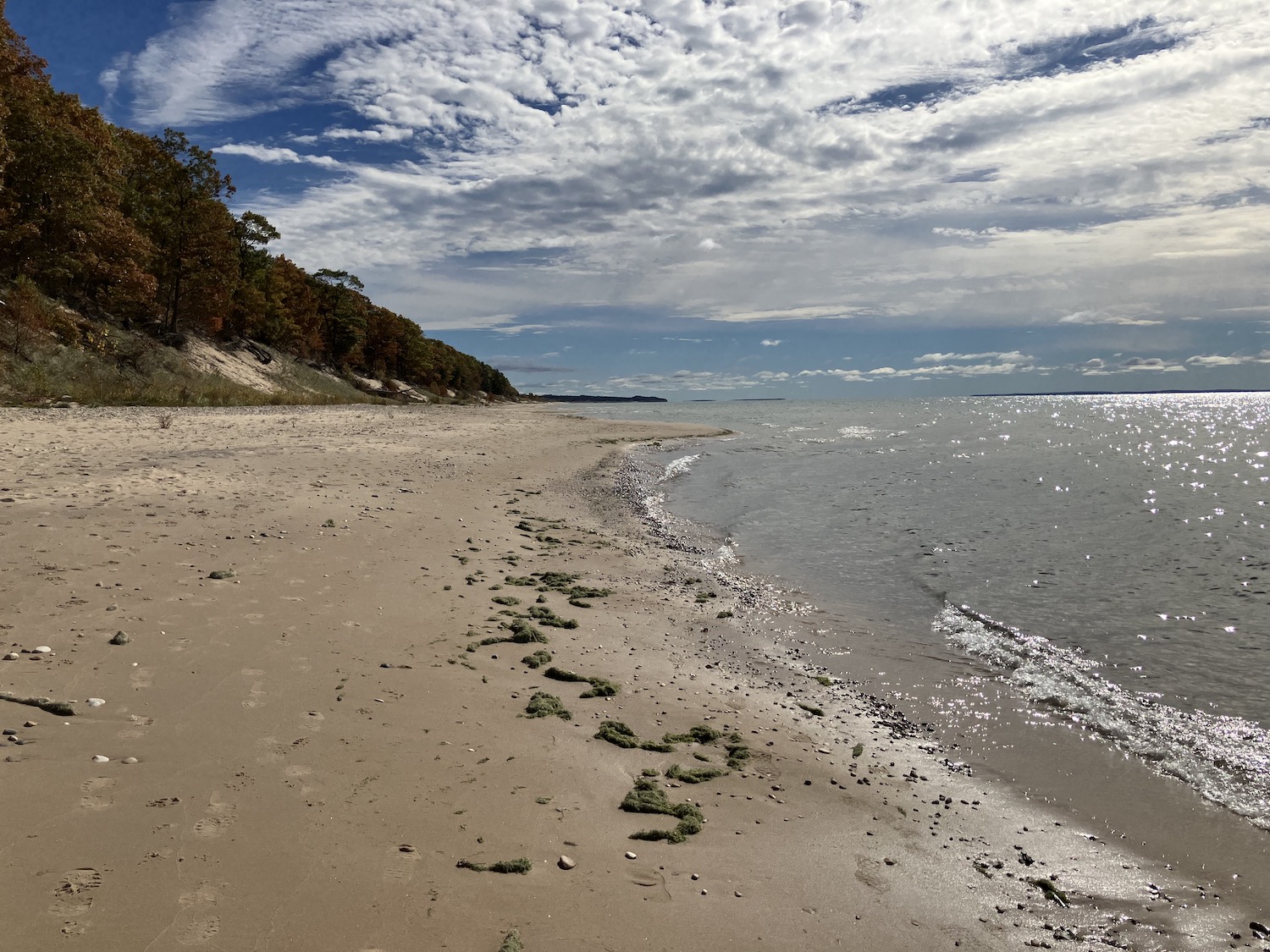
South Haven is not the lakeside town I knew in my youth, with supermarkets, local hardware, and dimestores downtown, along with small industries and regional tourism. No, it has given over completely to a tourist town identity, and instead features fudge shops, souvenir stands with tacky teeshirts, ice cream–and lots of restaurants, bakeries, and other assorted treats. Food was not a problem, but I puzzled where the local folk got their groceries and bought nails. Holland? I suppose. That city has become a massive sprawl that I largely avoid these days. Headed back, then stopped at Weko Beach, which, owing to relatively recent acquisitions by the state, is now directly adjacent to Warren Dunes State Park, where I spent so many years amidst its woods and drifting sands.
I walked and walked and found myself in the past: my past–these hills were so very familiar to me–and the distant, geological past. All one, all wonder. I was sixteen again, and lost in time–and the Dunes held the answer to all.
Finished the evening with a walk along the beach to the mouth of the creek that quietly sidles into the Lake, bathed in the sunset glow. My soul at peace, I slept well.
So lovely to awaken refreshed the next morning amidst tall pines and hardwoods with the Lake in view–not to mention the woodpecker alarm. The spartan room–luxurious, perhaps, in 1915–suited me fine. Coffee and a bite or two of the scone purchased the previous day, then one more descent to the Lake to bid a long farewell.
Headed back in a leisurely fashion with a stop in Three Oaks, very changed indeed from my childhood, when it was a little agricultural village (it’s the town featured in the movie Prancer) that had a bowling alley my parents often went to on weekends. Still, if you’re going to go all touristy, they’ve mostly done it right. Three Oaks exudes charm. The old corset (yes!) factory houses a theater and artist studios. There are fancy shops, but also a butcher shop dating to the turn of the last century, where my favorite poet Carl Sandburg shopped, for goodness sake! It has not changed much since. The old Featherbone Company building is now the town library. Three Oaks has kept its head.
Hard to go. I can depart from Michiana, but it never leaves me.
After a night at cheap chain motel in Appleton, Wisconsin, having descended from Door County the evening before, I was off to Baraboo, a little over a hundred miles on winding roads through the heart of the state. The day was sunny and the terrain rolling, the landscape agrarian. I saw a sign or two directing folks to such-and-such supper club, a Midwest (particularly in Wisconsin) institution that has nearly disappeared. These were sort of a combination affordable but nice dining establishment and social club. There might be entertainment and/or dancing, but food and socializing were the key elements.
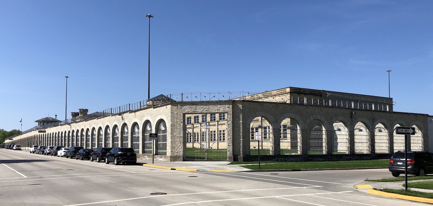
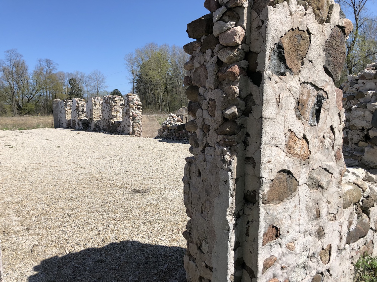
Wisconsin State Prison at Waupun
I reached the town of Waupun where I was changing highways, and I stumbled on an amazing structure I wish I could’ve explored further (and stopped to photograph properly). Parts of the castle-like Wisconsin State Prison complex were constructed in the 1850s and are still in use. The whole thing is listed in the National Register of Historic Places. I was meeting some folks at the Aldo Leopold Center and I still had quite a ways to go. I reached Portage–a town worth exploring another time, I thought–and headed onto Levee Road, one of Wisconsin’s “Rustic Roads,” which translates to your getting the experience of what most roads were like before World War II. After about eight miles of washboard jouncing, I pulled up to the Leopold Center.
Aldo Leopold is one of my heroes. Many decades ago I ran across his book A Sand County Almanac at a used book sale; intrigued by the title, I purchased it. When I got around to reading it, I was transfixed and continued to dip into its pages at regular intervals. Much later in graduate school, my professor used it as one of the textbooks for his class on environmental history. Leopold was a graceful and descriptive writer, who penned essays on his experiences and observations during his time he and his family were working to restore a wornout farm some 50 miles north of Madison along the Wisconsin River. During the week Leopold taught at the University of Wisconsin and on weekends headed up to his “sand farm.”
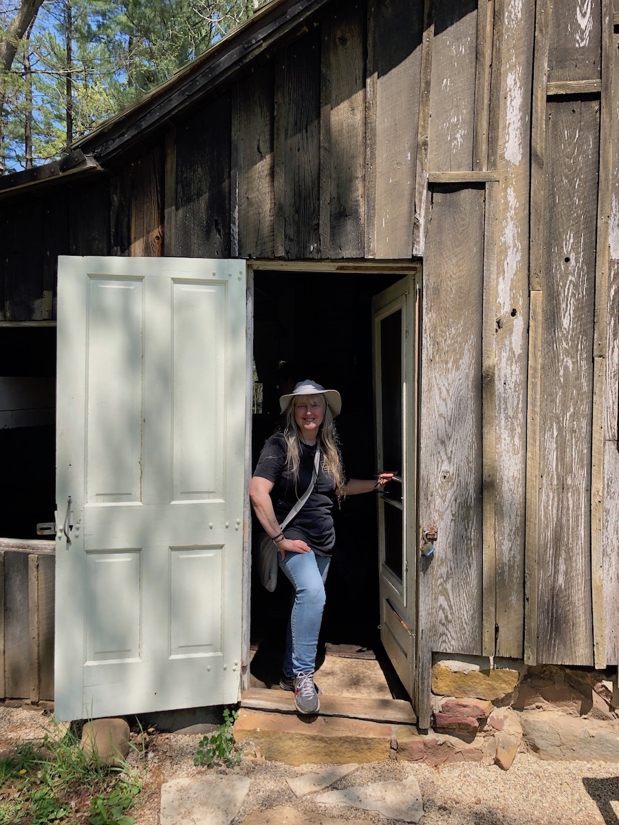
Standing in the entrance of Aldo Leopold’s Shack
I met the folks who were going to give me a tour into the Shack, a National Historic Landmark. I had seen the Shack before on earlier visits, even scooped up gravel from the bank of the nearby river (which I still have, displayed in a wine glass) but I had never been inside. The structure and its surroundings have been undergoing a major restoration and stabilzation project. Whereas during my previous visits the Shack was not visible from the road, largely obscured by a forest of pines that Leopold had planted, it now was plain to see, with the prairie restoration well underway before it.
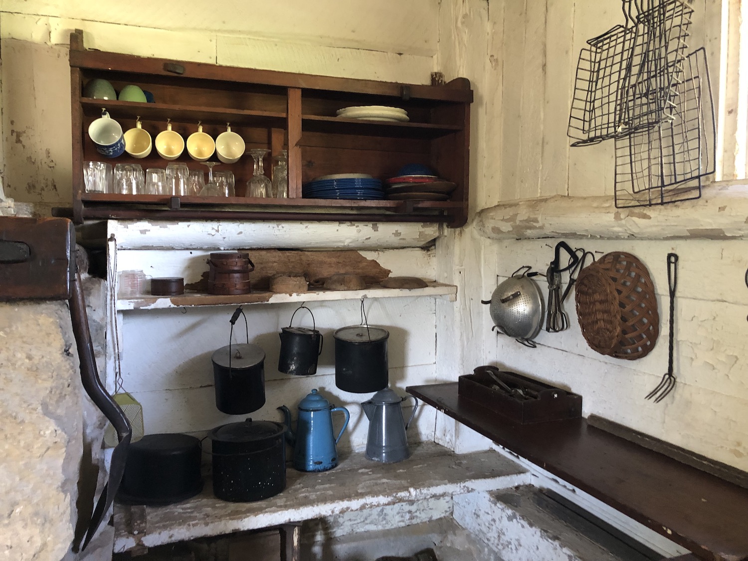
Interior of the tiny Shack where the Leopold family spent their weekends
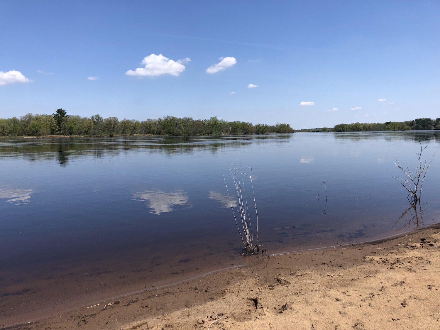
Did I mention what a glorious day it was? The bluest of skies. Sun like summer. Air clear and fresh. We went down to the river and talked of Leopold and cranes and wonder. I ran my fingers through the many-colored stones that form the gravel bed of the river. Heaven.
Wisconsin River behind Aldo Leopold’s Shack
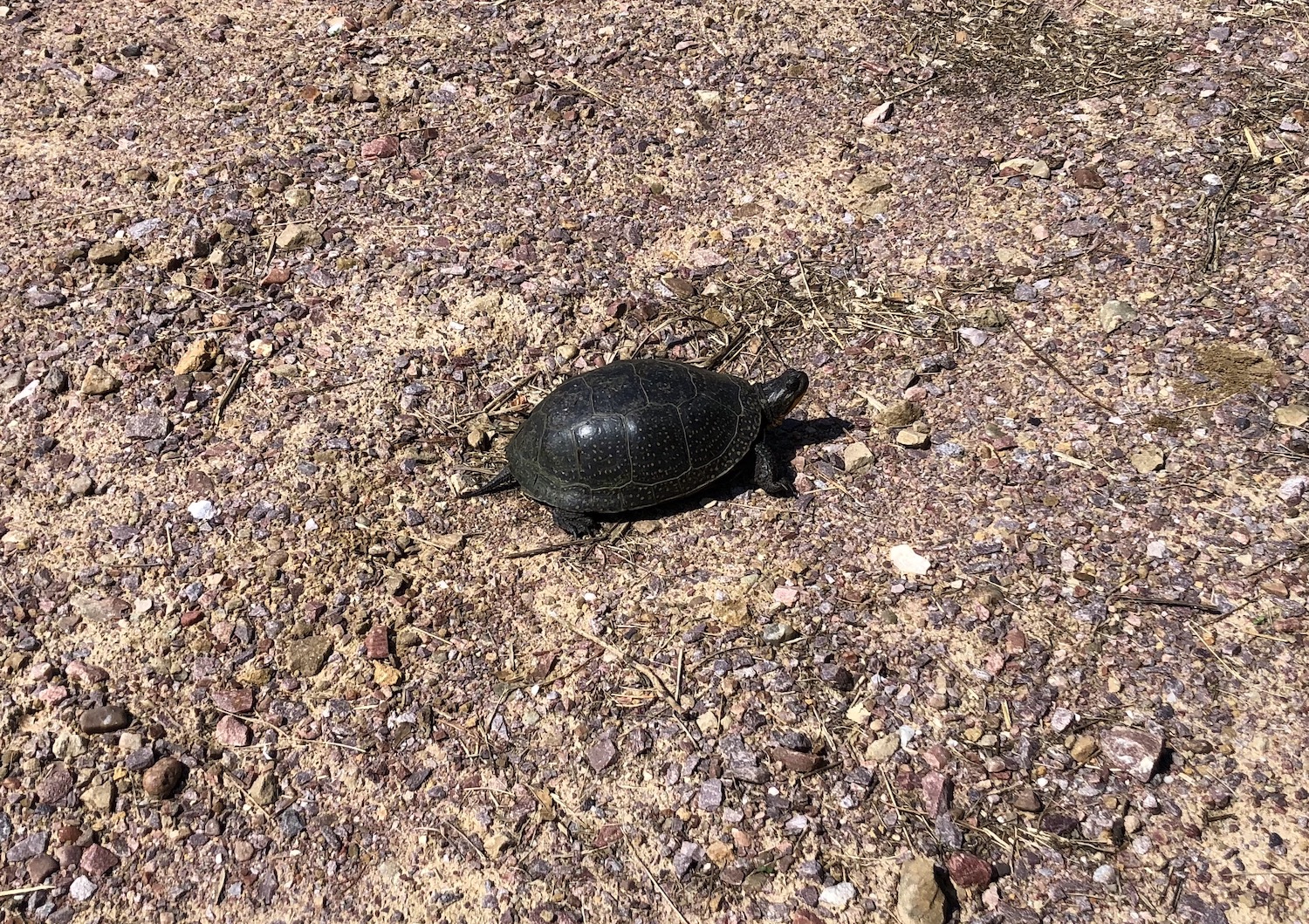
We returned to the center, talked more, and said our farewells, but as I was crossing the parking lot I encountered a turtle about which I had suspicions!
Blanding’s Turtle spotted in the parking lot of the Aldo Leopold Foundation
I gently guided it out of harm’s way and later confirmed that indeed, it was an endangered Blanding’s Turtle! I notified the folks at the Center. I had never seen one before except in captivity at Pokagon State Park in Indiana.
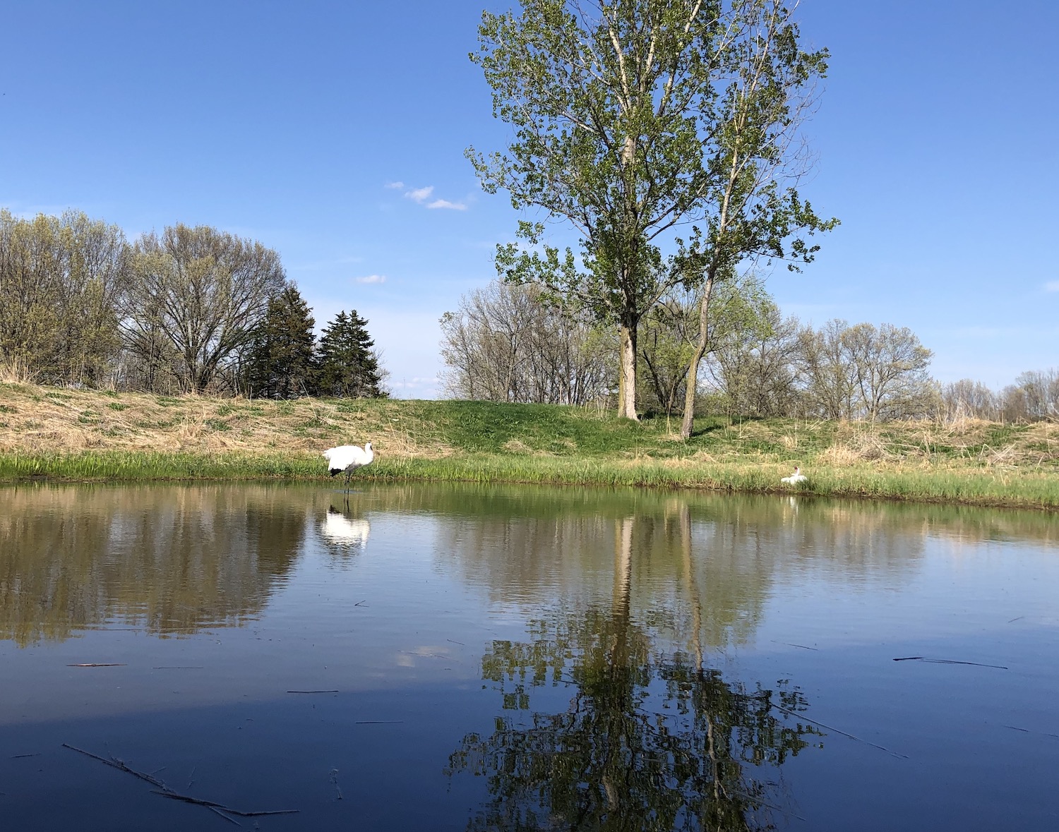
I headed a few miles west and stopped at the International Crane Foundation, once again to admire their refreshed and enlarged headquarters and exhibit spaces that had opened in 2021. I’ve been a member for many years. Pairs of all fifteen of the world’s cranes are on display, now in habitats that mimic–as best as can be done in a northern Midwest clime–the areas in which each lives in the wild. Cranes live on all continents except South America–and Antarctica, of course. North America claims two, the now multitudinous sandhills and the still-very-endangered whooping cranes. Many others around the world are endangered, too, and very good interpretative signage explains the status of each and what is being done to help. I took my time and wandered amongst them all.
Pair of whooping cranes at the International Crane Foundation
Famished by this time, I headed into Baraboo and checked into the 1950s-era Spinning Wheel Motel–my kind of place. The room was neat, clean, and comfortable. I headed downtown in search of supper; the Little Village Cafe looked intriguing, and the food proved to be delicious. The place appeared to have been a typical diner in the past, now scaled up. As there was still a bit of light left I took a drive up to the Dells, but its tackiness overwhelmed me. The Dells themselves, beautiful cliffs and fantastical formations along the Wisconsin River, are still there, of course. The previous fall I had taken a boat ride and enjoyed what millions of tourists have experienced for over 150 years. But the town’s garish signage, blinding lights, and plethora of oddity museums and tacky tee shirt shops seem to attract many people more than nature’s wonders. Ugh. Much of the route between Baraboo and the Dells on US12 is lined with these so-called attractions, but I discovered an old route back that took me almost directly to the motel through the lovely countryside.
Jen’s Alpine Cafe, founded 1930, in Baraboo, Wisconsin
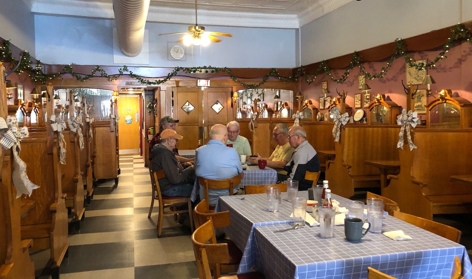
The next morning I headed to one of my favorite restaurants anywhere, Jen’s Alpine Cafe, a time warp into the 1930s. They offer fabulous breakfasts and the atmosphere is just. . . so cool! All decorated for spring, it looked lighter; I’ve never been up here this time of year. Delightful to experience spring all over again. I wrote for awhile and then took a walk around downtown Baraboo, with its spas and health food stores–and bars and tattoo parlors, mostly in historic buildings. What a mix of people inhabit this town! Working folks and roustabouts, scientists and environmentalists. And of course thousands of tourists, the majority probably for the Circus Museum (which I’ve never seen) and Devil’s Lake State Park, never mind some spillover from the Dells. A pleasant dreamy morning–it was difficult to leave.
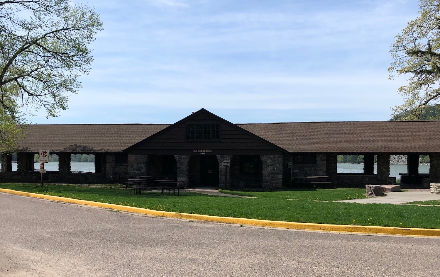
CCC-built shelter at Devil’s Lake State Park
I wanted to stop in Devil’s Lake to check out the work of the Civilian Conservation Corps (CCC, the New Deal agency that employed two million young men to do conservation projects during the Great Depression) in the park. The last time I’d been in the area I purchased a book describing the work that took place during their long encampment at Devils Lake, and I was eager to see how much of it was still there and still in use. The park also held memories for me. Years back, when I lived in Chicago and my parents still dwelt in Michiana, they occasionally took a weekend trip to south central Wisconsin and visited Devil’s Lake, Mirror Lake, and just wandered the backroads (you see it comes naturally to me). A couple of times I went with them, discovering Baraboo, Lodi and the magical glacial moraine and sandstone bluffs. That was a LOT of years ago, and I couldn’t place any particular location in the park, but it all seemed vaguely familiar.
Merrimac ferry over Wisconsin River
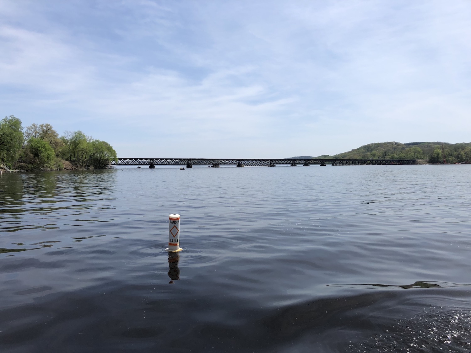
I had miles to go before I slept, so I finally left, continuing down Highway 113 toward Merrimac, where I hoped to catch the car ferry, although I had been warned that it might not be open yet. But it was. I do enjoy this experience of crossing the snaky Wisconsin River, a mile wide at this point. The ferry, called Colsac III (a merging of the two counties it links–Columbia and Sauk), has been in operation for a hundred years, although this particular boat, larger than its predecessors, dates to 2003. Free since 1933, it’s the only ferry that survives in the Wisconsin highway system. Many times it was threatened with replacement by a bridge, and in the late 1960s it was thought that the new interstate bridges not that far off would render it obsolete, but the ferry is much loved and likely will remain. I always imagine that Aldo Leopold and his family must have taken the same ferry to get to the Shack from Madison.
Wisconsin River from the ferry leaving Merrimac
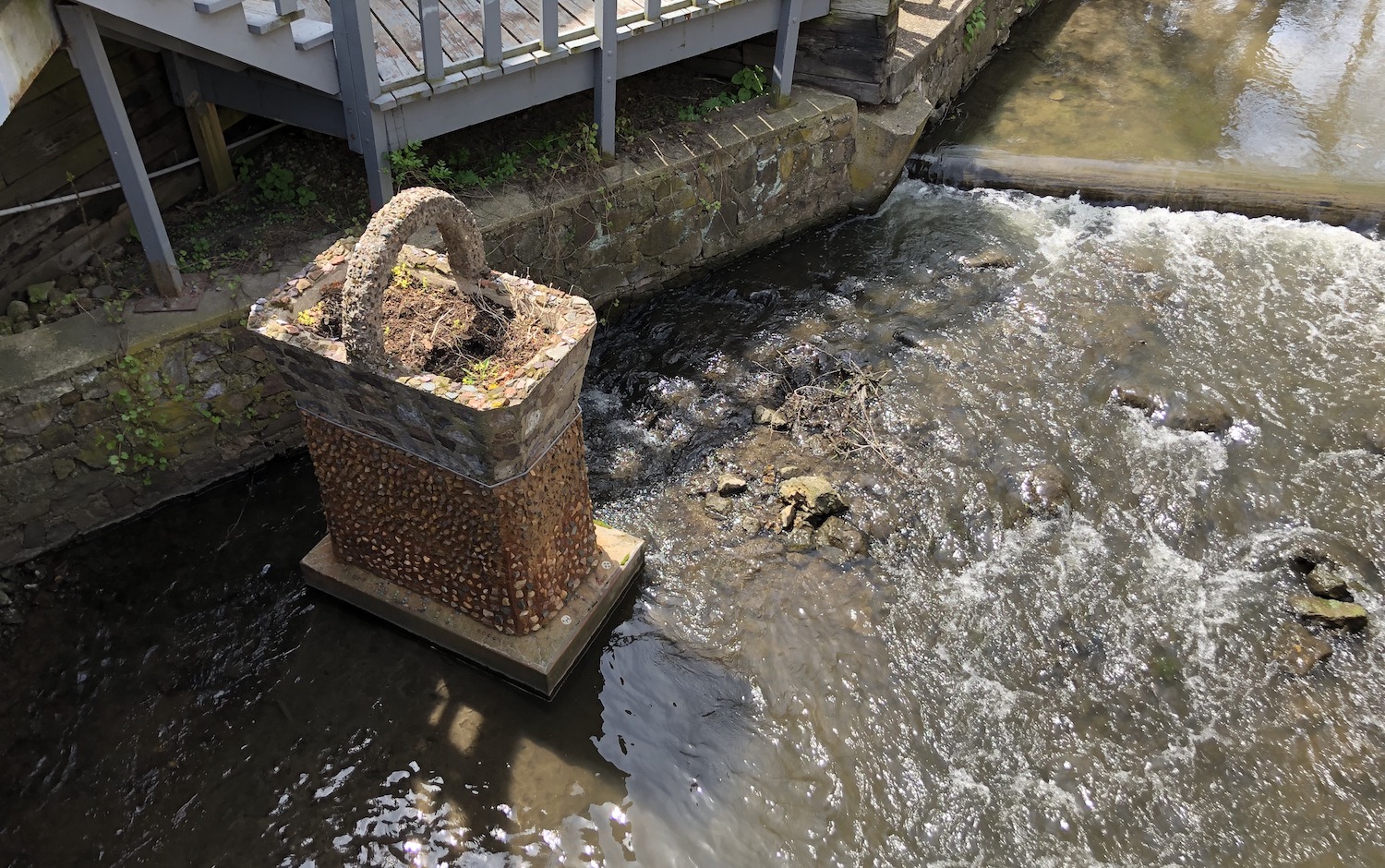
Not far south past the ferry is the charming town of Lodi, a place I remember seeing with my parents all those years ago. Lodi is noted for Susie the Duck, originally a female mallard that in 1948 nested in a WPA-built stone planter along the creek that runs through town. There have been many mallards since, and forty years ago Lodi started an annual Susie the Duck festival, which has grown into quite the regional attraction! I stopped for a bit at a favorite place, the Buttercream Bakery (and ice cream shop) overlooking Spring Creek.
Too early in the season for “Susie” the female mallard to nest in her favored basket in Spring Creek
Yes, miles to go before I slept, so onward, save for a stop at my favorite cheese shop (this IS Wisconsin, after all), Ehlenbach’s Cheese Chalet, third-generation family-owned. Their morel mushroom and leek jack is pure magic. At Janesville I decided to take old US14, which was lovely in its early spring garb. I marveled how clean the roadsides were, consistent throughout the state, unlike those in Indiana, sad to say. US14 sidles into Illinois at an angle until a few miles north of it, but after I crossed the border I made some poor decisions. They led me into that sometimes dreary endless prairie of east central Illinois where the roads seem to go on forever. I also tend to forget how very north Illinois extends above Indiana’s northern reaches.
More poor choices took me to I-65 after dark and numerous traffic jams from construction. I kept my cool, mostly, not wanting to lose the wonder, peace, and joy of Sand County.
So I had finally made a journey around Lake Michigan, and it was wonderful. But owing to insufficient time, not to mention the rain my last day out, I had missed a lot of the “wrong side”–that is, Wisconsin. I wanted to go back and see more of the western shore and some of fabled Door County. An opportunity arose when I was invited by the Aldo Leopold Foundation for an inside tour of my hero’s Shack near Baraboo. I had discovered Aldo Leopold decades ago, when I found A Sand County Almanac at a library sale. The title intrigued me. (I now have several copies–I dip into the book regularly–and it was required reading for my Environmental History class in graduate school. Most of it was written at the Shack.) Yes, that lies pretty far west of Lake Michigan in the central part of the state, but I reasoned I could take the day before along the shore, spend the night, and leave for Baraboo the next morning.
Choosing to dash through Chicago straight to Wisconsin proved surprisingly easy, a quicker trip than I thought. I bypassed Racine, as I had driven through it on my previous trip, and skipped Milwaukee again, although this time I took the interstate that sliced through it and was intrigued by its historic buildings––ah, another time! It has been decades since I visited there. And––Lake in view!
Looking east from Lake Church, Wisconsin
Once past Milwaukee, I got off and headed straight east to the Lake through a crossroads called Lake Church, the land around pleasantly rolling and the day, glorious.
Lake Michigan near Lake Church
Before me rippled the vast freshwater sea from a different vantage point than usual. So odd to be on this side. Sand, but no dunes here; they are formed through the actions of the water and the prevailing westerly winds across the Lake. Ah, the swoosh and lapping of the waves does me much good.
Amsterdam Dunes Wisconsin
From beach to beach I hopped; my next stop Amsterdam Dunes––I almost want to put quotation marks around that! There is a small park, perhaps a 20-foot ridge of sand, and then a lovely little beach––but nothing I would call dunes. Still, it is the Lake and it caresses my soul.
Intriguing ruins of a barn near Amsterdam Dunes
I follow Sauk Trail Road and wonder if it references the same band of native Americans as does the road of that name in Indiana. Might it even have been a continuation of the same trail? Or perhaps a southward leading route to a meeting place at what became Chicago? I vaguely mull over these things but lose myself in the beauty of the day. I reached Hika Park near the village of Cleveland, about halfway between Sheboygan and Manitowoc; it’s a flyway stop for migratory birds and boasts a wealth of habitats typical of the ridge-and-swale topography once common along the Great Lakes––and all with appropriate interpretive signage. We must better understand this beautiful world of ours! And what a delight to discover a Leopold bench on the beach here! Such a simple design, it requires only six boards and is surprisingly comfortable. Leopold built several of these around the Shack and wrote many of his essays while seated on them; the design makes it easy to turn and rest a notebook on the corner.
Leopold bench at Hika Park
I passed through Sheboygan, which I had seen on my earlier trip, but stopped and took a brief walk around Manitowoc. Its historic downtown was not devoid of occupants and interesting shops but largely empty of people. Well, it was late in the day.
downtown Manitowoc, Wisconsin
I needed to move on myself; I was hoping for a diner or drive-in (not likely in early May in Wisconsin) but spotted none. I came upon what was––up to that time––the largest solar array I had ever seen, taking over what surely had been several farms, going on for miles! Oh sure, once the power companies could get their greedy hands on it, solar power is in. And all that farmland lies fallow (unlike that beneath wind turbines, I note.)
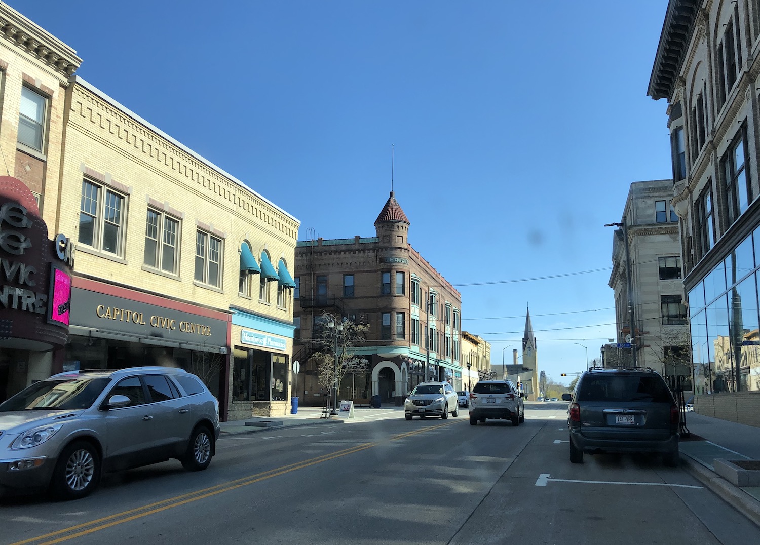
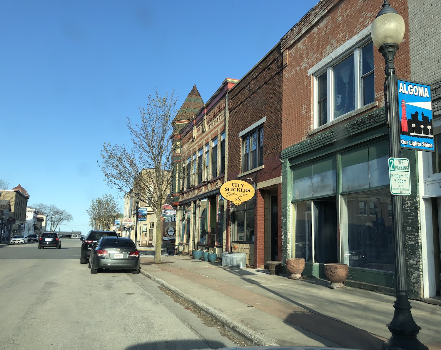
downtown Algoma, Wisconsin
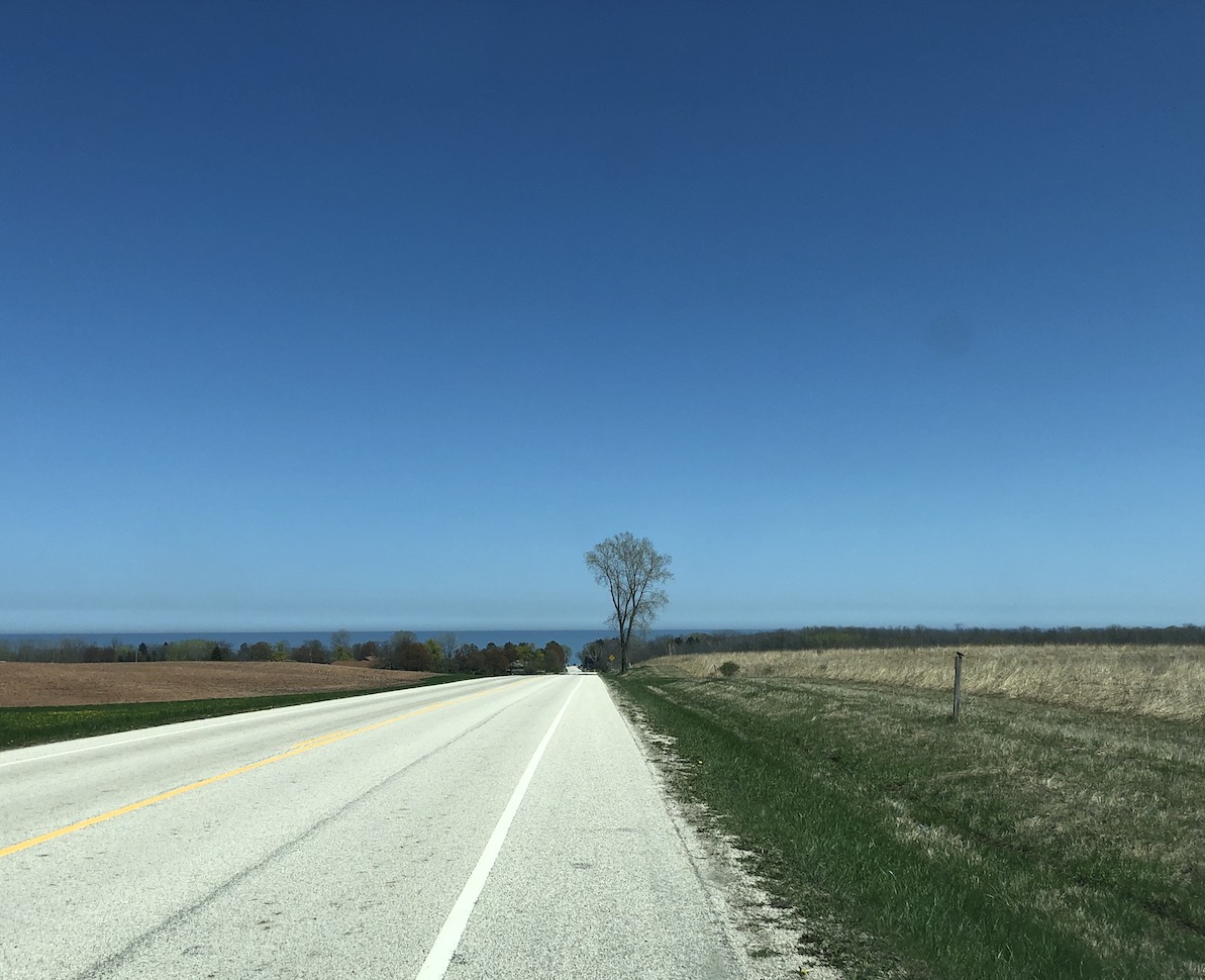
It was growing late and I had still not quite reached Door County, which was my goal, but I was hungry and, happily, came upon a little diner in Algoma. The town was filled with beautiful historic buildings, but the sun was descending and I was determined to watch it set at Sturgeon Bay, an inlet off Green Bay, so, onward northward. I could not help but celebrate the fact that I was experiencing spring all over again. Here the forsythias and daffodils were still wildly blooming. long gone back in central Indiana.
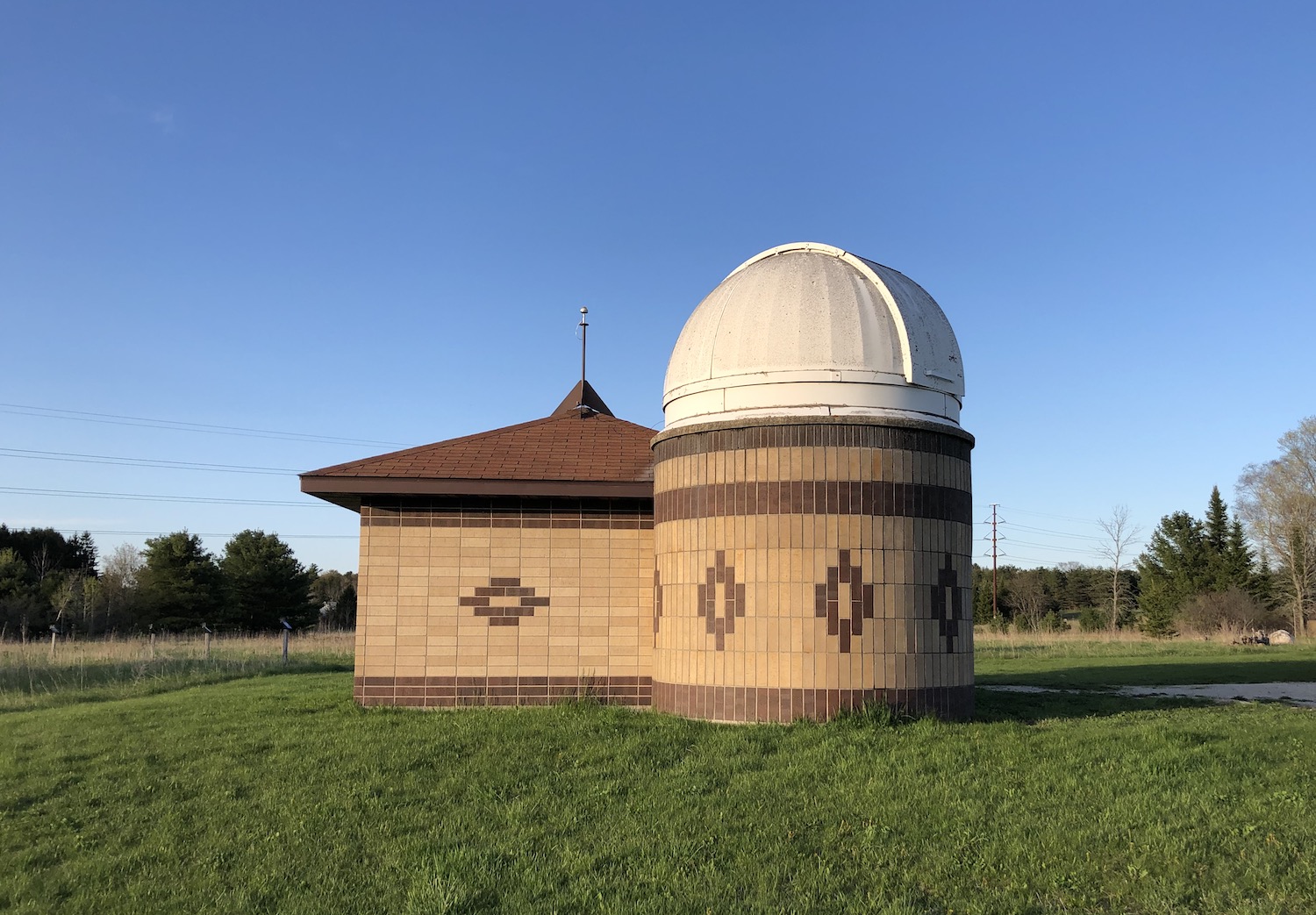
Observatory of the Door Peninsula Astronomical Society
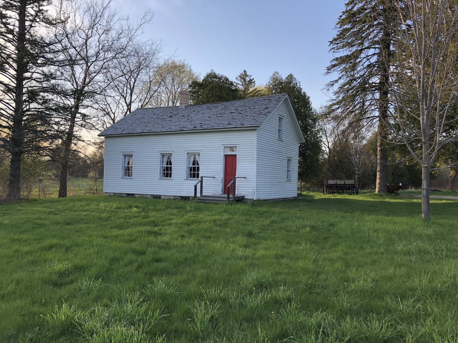
I reached Sturgeon Bay, crossed it, and wandered the area a bit, delighted with discoveries of an observatory and, for my historian’s soul, an 1857 Norwegian farmhouse, all within an area called Crossroads at Big Creek. Most of its 200 acres comprise nature preserves––a place worth exploring further!
1857 Norwegian farmhouse at Croosroads at Big Creek, Sturgeon Bay
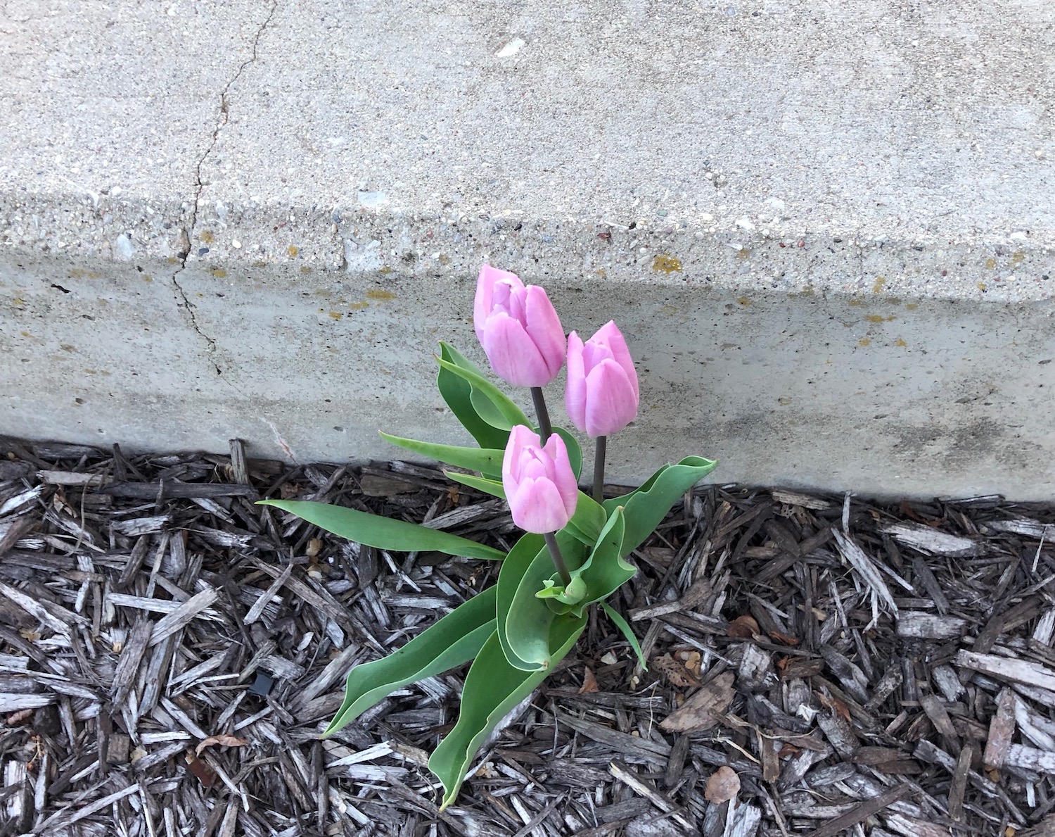
But now I needed to find the bay, and finding the town with which it shares its name proved a bit tricky. I found a small park near the mouth of Sturgeon Bay looking west toward Green Bay, and laughed with the tulips still blooming there.
tulips at Graham Park, Sturgeon Bay
Sunset beyond the open drawbridge was stunning, and I lingered long.
sunset, Sturgeon Bay, Wisconsin
Darkness was rapidly descending as I hurried south toward Green Bay (the city), which seemed to take forever. Knowing that the next day’s destination was in the center of the state, I continued on to Appleton until I found a motel. I’m sure these cities have their attractions, but urban areas held no appeal this trip and all I wanted to do was settle in to dream of the Lake and Leopold.